Home page: www.treks.org
Table
of Contents "On the road to Kabul and other short stories of treks"
A destructive flood in the valley of the Edelweiss

Female porters of the Tamang tribe near Tangnag, background broken
moraine dam of the Sabai Tsho Lake.
Last night
I had a splitting headache by the high altitude. We went from 2900 m to 4600 m in only 4 nights and the trails on
the mountain range were rough but very scenic.
Yesterday we
could not use the normal, low and easy
trail from Thuli Kharka to Tangnag as it was washed out by a large flood but
the Sherpas couldn't tell me what really happened. The alternative upper trail
was really poor and normally only used by yaks to migrate to summer pastures
high up in the mountains, up to 5000 m. We even had to use a rope at a steep,
rocky part once.
Today, in
the early afternoon, we finally went down into the main valley and Mart was
elated, photographing various colorful flowers.
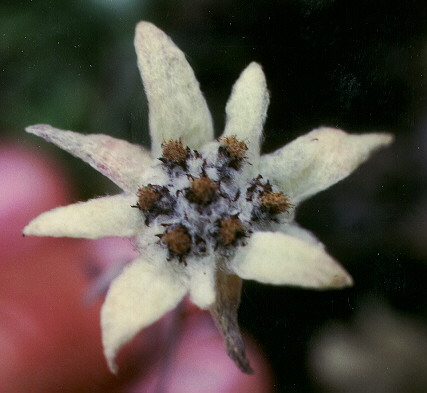
Small white flowers grew
everywhere and as soon as you left the trail you could not avoided stepping on
them. During rest breaks and 'pipi
machen', I must have squashed several. Mart had to tell me that these were
Edelweiss flowers and after some disbelieve I collected a few.
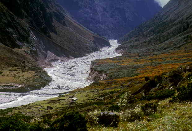
Hinku valley downstream, destructive flood visible in riverbed (white
rocks). Edelweiss flowers in the foreground.
Phurba Sherpa, our Sirdar,
said that this valley was known for its Edelweiss flowers, left untouched by
the yaks as they do not like the tough, nettle like stem. A Japanese man was
known to come here once a year to collect 2 suitcases but this is illegal. Even
the few Mart and I picked could get us into trouble.
On the way
down, I was carefully observing the river valley and already from a large
distance you could tell a destructive flood rushed through the valley recently,
see picture
above. Finally down in the river valley I could assess the scale of the
flood. In places the wall of water must have been 200 m wide and 10 m high or
100 m wide and 20 meters high, destroying the riverbed and main trail in
several places. This was visible on the bushes and gravel deposits. Close to
Tangnag, we finally saw the source of the flood.

Sabai Tsho Lake, view from a helicopter, lake 0.5 km wide.
The Sabai Tsho Lake which
is a half square km in size, had a
gaping hole in the 100 high moraine dam and the lake level dropped by 50 m.
After the dam burst, the lake must have dropped in a matter of minutes. The
enormous amount of water released made a devastating trail up to 500 m wide near
Tangnag carrying boulders of up to 1 m.
Only the biggest rocks, some 3-5 m across, seemed to have hardly moved.
This was a
very recent glacial lake outburst flood and somehow the natural moraine dam
broke. As it was the end of the monsoon season, we suspected heavy rain in
August or early September but we would find out soon after arriving in Tangnag,
see below.