Home page: www.treks.org
Table of Contents "On the road
to Kabul and other short stories of treks"
Crossing the Etna volcanoe
in one day, June 2003
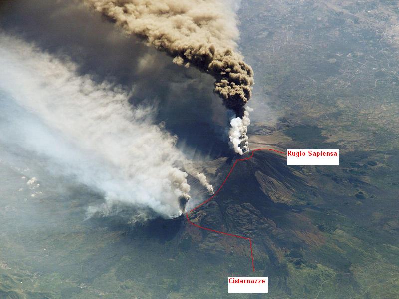
Eruptions of December 2002 with a view at the Provenzana area on the
North side. Cross Etna route indicated. Top of Etna 3300 m, lower valleys at
700 m. Picture from Webshots
'Nobody
will stop you!!!', the young volcanic guide told us when we asked if we could
ignore the ban on climbing Etna on our own. The next day, after sitting on a
snow and ash field among lava flows in dense clouds at the Central cone at 3100
m and just loosing the ash covered trail for the second time I wondered, we
were at the half was point and could still return. It was getting cold.
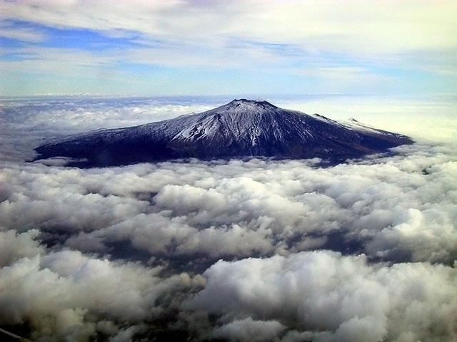
Etna in the clouds. Picture from Webshots
Volcanic activity
Since the
volcanic activity in 2001 and 2002, climbing to the Etna volcano summit at 3300
m is only allowed with a certified volcanic guide. Already above 2000 m
trekking on your own is banned but nowhere you will see signs.
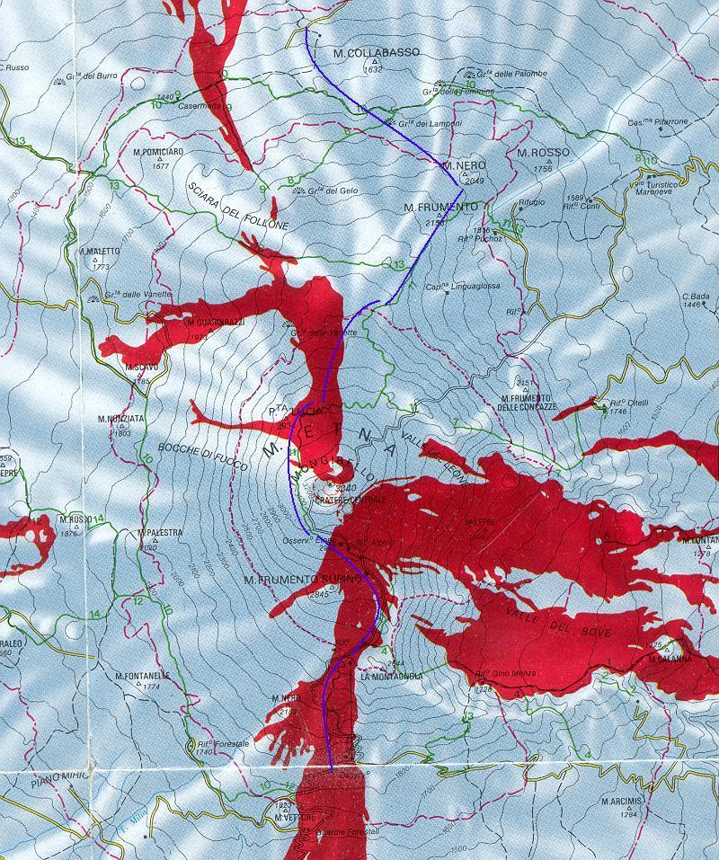
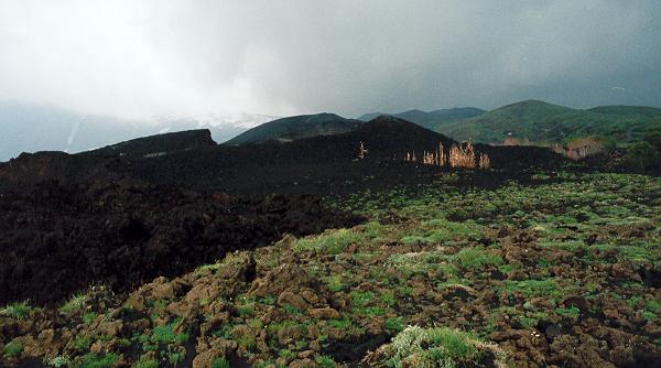
Big
eruptions in the 70's covered most of the top above the central rim with
several km's of lava flows, see figure above.
These black spongy rocks resembling black pumice crumble when stepping
on it and make the walking hard.
In December
2002, eruptions took place on the South side, nearly covering the buildings of
the Refugio Sapienza and Hotel Corsaro. On the North-East side, in the
Provenzana area, an old radial fault opened and a lava flow completely covered
the hotel, refugio and restaurant. To make it worse, a large black cinder cone
formed roughly on top of the buildings at Provenzana. Half a year later, the
lava flows are still fuming in places but it is save to cross them, in terms of
the temperature, not the loose blocks.
Reconnaissance
Etna is
easily accessible from many sides but we used the access road from Randazzo to
Cisternazze and from Maleto to Refugio Nave. We decided to do a few
reconnaissance trips from the North side as here there are extensive woods with
nice trails.
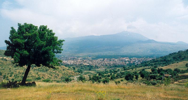
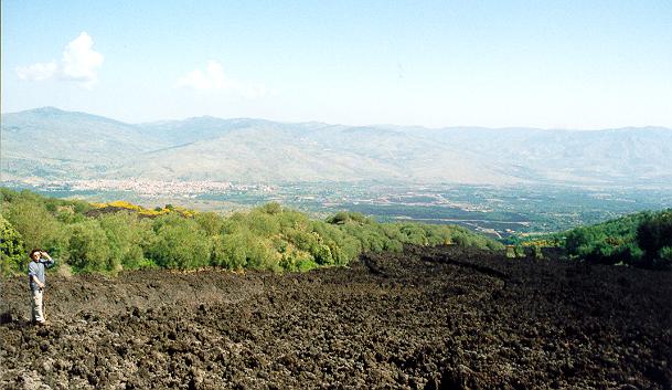
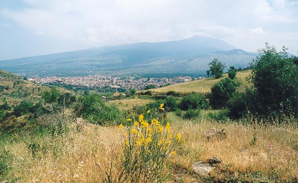
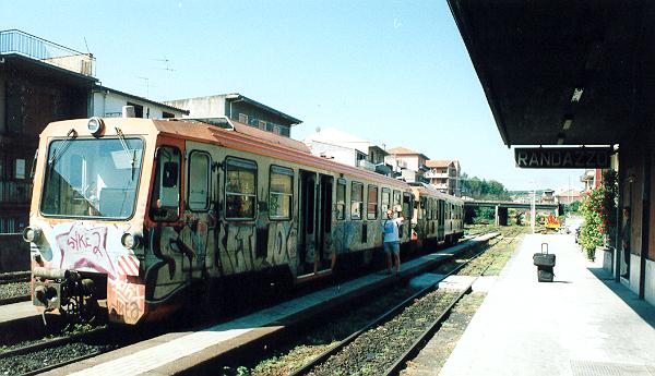
Randazzo with Etna in the back-ground, view to the South
Monte Nero
The first
day trip to Monte Nero ended in a heavy thunderstorm at the recent lava flows
of Provenzana.
Recent lava flow and cinder cone (middle) at Provenzana, just before a
thunderstorm.
Hoping to reach a remaining
building in time, the thunder hit us full at 2000 m before we could look at the
situation and for one hour we hid in the woods, the temperature quickly
dropping with hail stones coming down. The shelter under the trees was not good
but even worse we missed a good cappuccino. I was fine, clad fully in a
Gore-Tex coat and pants but Ruud was wearing only shorts and a wind jacket
despite the warning on the news this morning of thundershowers. He got very wet
and very cold but he is a “die-hard” (or “bikkel”), he said.
On going
back to the last hut, Ruud was dreaming of a warm fire and coffee, and after I
said that I saw someone at the hut from a distance he said 'We need an Antonio
who can make us a good cappuccino’.
Anthonio
was indeed there. He was a forestry student measuring trees and was sheltering
for the storm. He shared his freshly
made coffee and had a wood fire in the stove going that made the hut warm.
Two hours
later, at the Cisternazza access road, Salvatore was about to leave his cottage
near the refugio and he gave us a ride back to Randazzo. He is always there in
the week-end and next time we will drop in for wine.
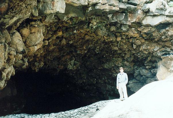
Grotto de Gello
The next
day the trip to the Grotto de Gello at 2000 m was much better. We only had rain
once and it was a bit cool but we sheltered in the cave of the Grotto de Gello
using the accumulated snow to go down. Here we met a family with a 9 year old
son and a 16 year old daughter on sneekers so you wonder how tough this trip
was.
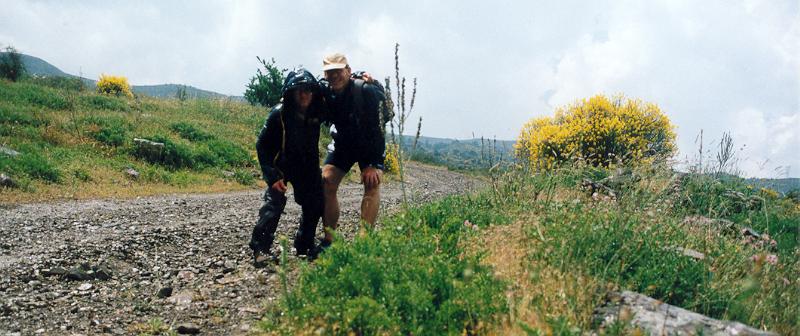
Pietro and
a friend from Nicolosi followed us to the Maleto access road at the Refugio
Nave, worried we may get lost, and as a bonus gave us a ride back to Randazzo
in their Jeep.
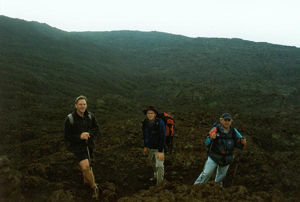
Pietro (right) assisting us in the lava flows West of the Grotto de
Gello.
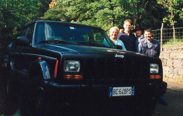
Pietro's Jeep.
Change of plans
We still
had not been higher than 2000 m and even the 2400 m region seemed unreachable.
The Etna rim craters are at 3100 m and
the top crater at 3300 m so we were worried we would never get there. This
called for a cunning plan.
In one day
we would walk the 30 km from Randazzo along the rim road to the South side of
the Etna at Refugio Sapiensa and stay in the Hotel Corsaro at 1900 m. The next
day we would take a 4-WD bus up to 2500 m and walk back to Randazzo, an 10 hour
trip we estimated but felt unsure.
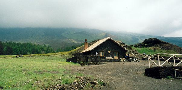
The walk to
Refugio Sapiensa took 9 hours as Ruud had trouble with a foot but we could
easily have done it in 8 hours. The Hotel Corsaro is a three star hotel with
good food. Temperatures drop to low temperatures at night.
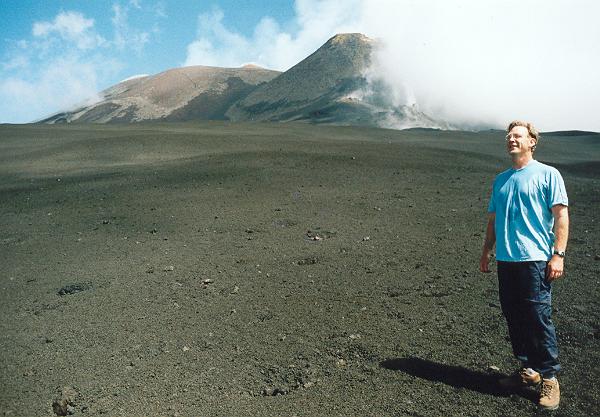
Etna summit
The
mountain guides at Sapiensa wanted to charge us 400 to 450 Euros for taking us
across, much higher than the Euro 220 for a private guide for the day. We
thought his was a bit much for reading a map, Ruud and I having 30 years
experience each, and we did not come to an agreement, also because no one was
available as this seem to be an unusual request. After some talking, and
getting impatient, 'Nobody will stop you!!!', a young volcanic guide told us
and he said he would be pleased to take us up but tomorrow he was busy in his
regular job.
The next
day in the early morning, an older guide said that the weather was perfect and
we should go for it without a guide. The hanging around and waiting patiently
paid off and the ticket up in the 4-WD bus was 30 Euros each, saving a 600 m
climb but I would have rather started earlier and walk up myself.
The 4-WD
bus took us up from 1900 to 2500 m in only 20 minutes. At 10 AM we arrived and
quickly left the crowd of some 100 people and 10 buses at the Monte de
Philosophico at high pace as if we knew what we were doing. We heard a whistle
only once in the far distance and wasn’t sure it was for us but ignored it and
quickly were out of sight. The 4-WD trail leading to the top was fine although
in places covered by 20-50 cm of loose ash from the 2001-2003 eruptions.
After one hour we reached the summit rim and the trail was invisible, fully
covered by ash. A bulldozer was at work restoring the trail from the winter ash
falls.
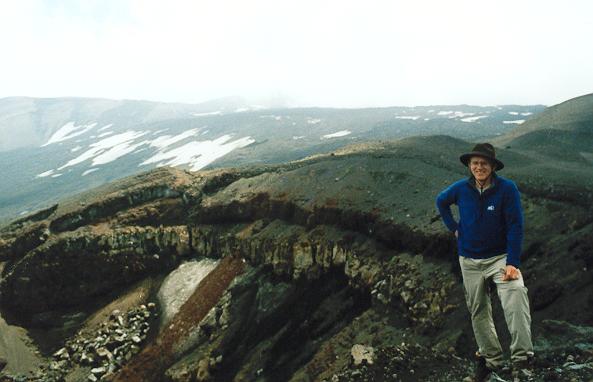
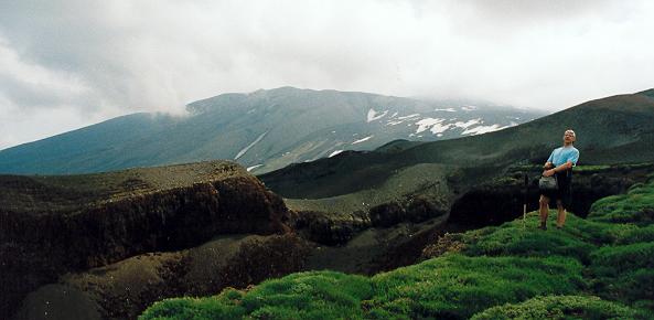
Summit area of Etna at 2900 m with Northern crater, view to the North.
We followed
the rim and after 500 meters Ruud found the trail back. Do not follow the
tracks up as they lead to the crater,
the trail stays on the outer rim following the contour lines. It took us
to the central crater. Here we lost the trail again in the numerous snow fields
and thick ash cover. It was now noon and the afternoon clouds were rolling in.
We were at the half way point and could still return easily but this would be a
defeat. We wanted to go North, back to Randazzo.
After 15
minutes the clouds lifted and we could see Punta Lucia, a clearly visible point
at the edge of the rim, and found the trail again. It was some 50 meter elevation
down where you expected it. Now the going was easy and the trail clearly
marked. Aim at Punta Lucia when you loose the trail.
As most of
the trail would be destroyed going down to Provenzana as explained by the
guides, we decided to use the snow fields on the lava flows from the seventies
to go to the Grotto de Gello trails. This was a good choice, the snow fields in
early June were continuous and very
easy walking going downhill and we quickly covered a 2 km distance
perpendicular to the elevation contour lines.
When the
snow fields stopped we were in trouble again and the going very rough on
crumbly lava blocks and small rocky hills. Luckily we saw the row of small
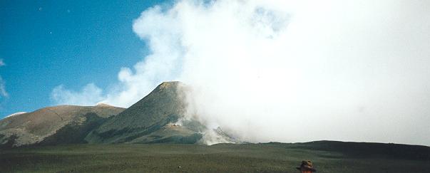
craters near Monte Pizzillo and the very distinct Monte Nero although I could
not believe we were already so far North-East. The volcanic observatory was
visible in the far distance and the trail was half destroyed by land slides and
the earth opening but it was relatively easy walking. This area was active in
the seventies and again recently. Several fault cracks were visible and in
places smoke still comes out of the ground. The ski lifts were destroyed in the
seventies and only green poles and rusted cables were left over.
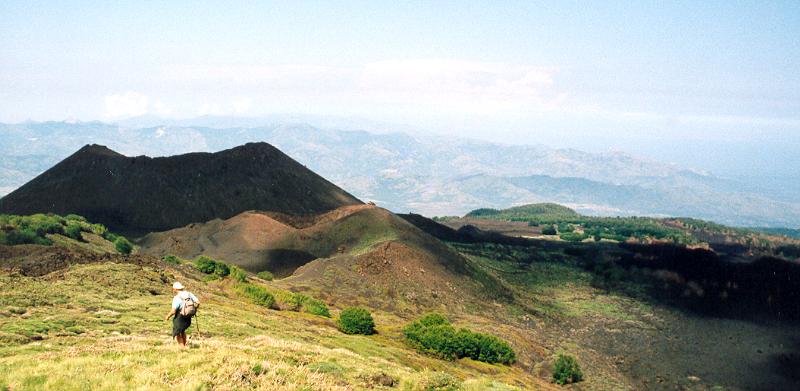
Row of craters, view to the Etna.
The row of
craters are spectacular and here we could easily orientate again helped by a
tourist sign indicating the names of the craters and mountains. We had a
splendid view at the 2002 lava flows of Provenzana and the big black cinder
cone. This was perhaps the most spectacular part of the trip, even more than
the summit. Here we had lunch.
We carried
on through the rough terrain to reach the main trail near Monte Nero and at 4
PM we finally reached the hut West of Monte Nero.
Monte Nero, a black cinder cone from a few centuries ago.
It would be another 2 hours
back. On taking a short cut along Monte Santa Maria back to Sisternazza, Ruud
saw a big snake, a Papa Miranda like they have in Nicaragua, and insisted on
returning. On going back we met a group of
40 pensionates and they were from the Milan Alpine Club. Their guide
assumed we were lost and told us to follow, he knew the trail. We had no choice
but to follow them. Now Ruud was save, protected by the crowd.
Group of 40 pensionates using the short cut through the snake area at
Monte Sante Maria
At
6.15 PM we reached the road, the trip
took us only 8.5 hours. The pensionates had a big bus and gave us a ride back
to our hotel were they also stayed. Luckily they did not fill up the hotel as
we returned a day early.
Epiloque
The trip
across Etna going from the South to the North is feasible for experienced
trekkers. You have to watch the weather, a thunderstorm is no fun but in early
June the summit is generally clear in the morning and is often only partially
covered in the afternoon, with clouds lifting at times.
The easiest
access is from Refugio Sapienza, it is only a 400 meter walk up after getting a
Euro 30 ride to the Monte de
Philosophico but the access from the Provenzana area at 2000 m in the North is
much nicer and you will not run the risk of being stopped by a guide. A one day
trip from here should be feasible but you have to watch the rough terrain. You
could aim at the upper ski lift pole (Coccinelle on the detailed map) and
follow the road up, roughly aim right
of the Observatory if you loose it in the landslides. Alternatively, start at
the Refugio Citelli 3 km South-East from Provenzana and aim for the observatory
on the upper rim. The trail on the upper rim is reasonably visible, stay along
the contour lines if you loose it.
If you
cannot read a map, do not try it or get a guide, the terrain is very rough when
you loose the trail in the clouds you can be in trouble in the rough terrain
and high relief of some 1500 m.
Other pictures
|
TITLE (to
click on) |
File name |
Date |
|
etna14.htm |
Unknown |
|
|
etna14.htm |
June 2003 |
|
|
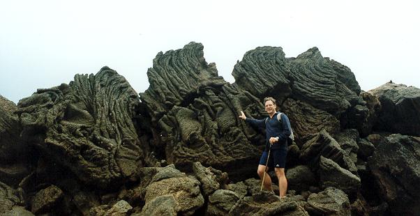
Ruud posing at the rope lava (pahoehoe)
near the Grotto de Gello. |
etna15.htm |
June 2003 |
|
etna16.htm |
June 2003 |
|
|
etna19.htm |
June 2003 |
|
|
etna21.htm |
June 2003 |
|
|
etna24.htm |
June 2003 |
|
|
etna27.htm |
June 2003 |
|
|
etna29.htm |
June 2003 |
|
|
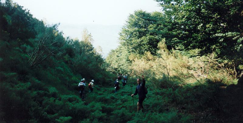
Jean and Ruud getting wet in
thundershowers in the Nebrodi National Park. |
etna30.htm |
June 2003 |
|
etna31.htm |
June 2003 |
You are visitor #![]() since June, 2003.
since June, 2003.