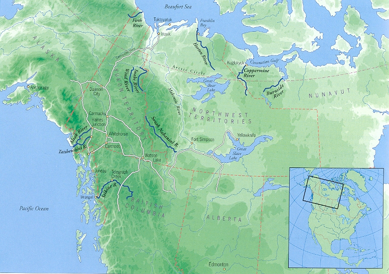
Google Earth tour of the Firth River (made by Ian Cumming) (Google Earth, View, Play Tour, Select point to start).
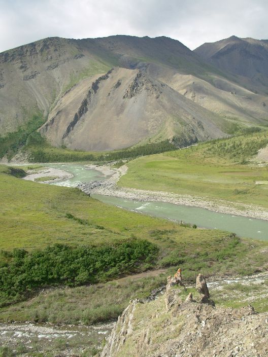
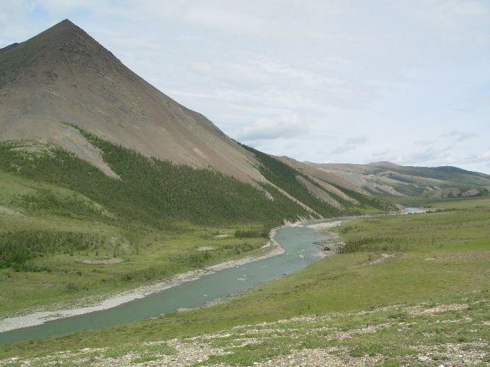
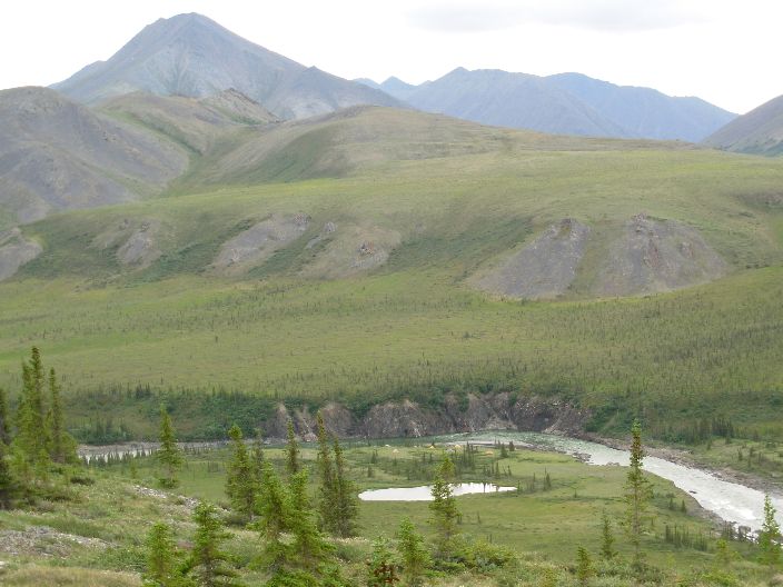
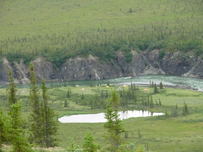
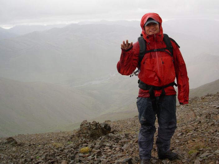
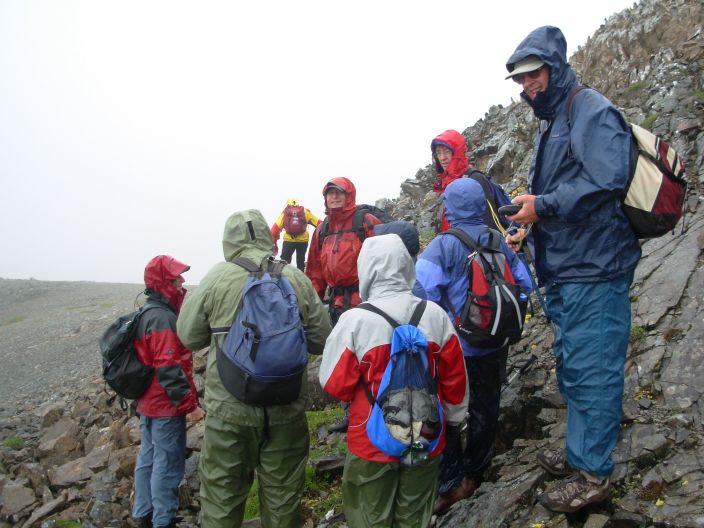
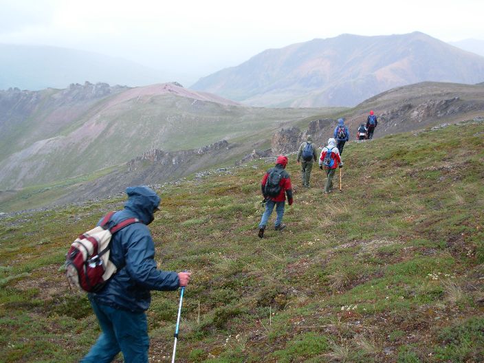
Photos from Ian Cumming, #1 #2 #3 #4
Information on the Firth River: the Ivvavik National Park, ANWR and Porcupine Caribou Herd.
(updated 12 August 2006). Visitor:
Google
Earth tour of the Firth River (made by Ian Cumming) (Google
Earth, View, Play Tour, Select point to start).
Photos from Ian Cumming, #1
#2
#3
#4
Information
on the Firth River: the Ivvavik National Park, ANWR and Porcupine
Caribou Herd.
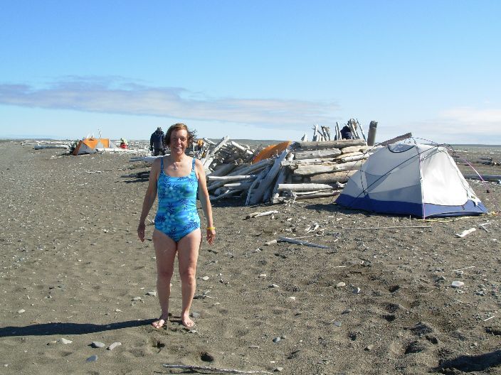
Sitting on a large driftwood log, I am staring at the icebergs in
the Arctic Ocean [1]. Back after 17
years, same blue sky and same strong wind but in the Western Arctic
it is much warmer than on Ellesmere Island [1],
15 C in stead of only 4 C. We saw a herd of 20 musk-ox's today, with
binoculars at a large distance.
The beach is full of driftwood [1] but I do not see any plastic bottles or fishing nets.
All cleaned up by Parks Canada?
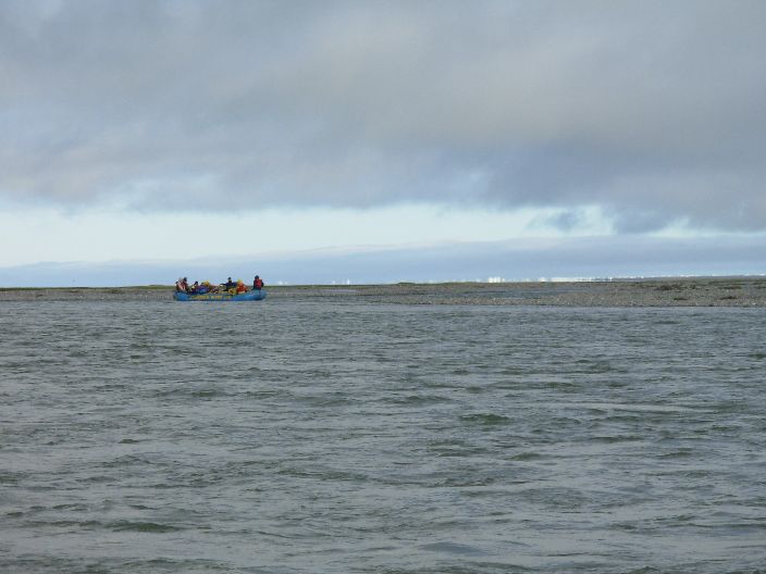
Tomorrow a Twin Otter will land on the spit, a gravel bar with a
rough 300 m landing strip [1],
and take us back to Inuvik after a 12 day rafting and hiking trip
down the Firth River.

Driftwood on the beach.
For location see Google Panoramio.
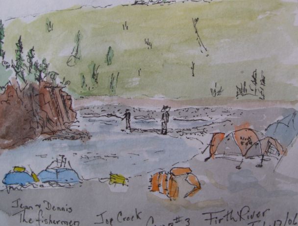
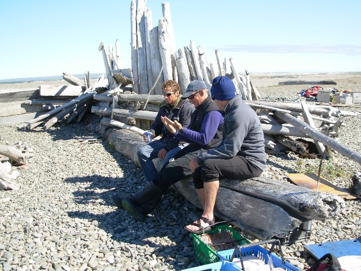
Dennis and Jean fishing at Joe Creek. Drawing by Donna [1]
[2].
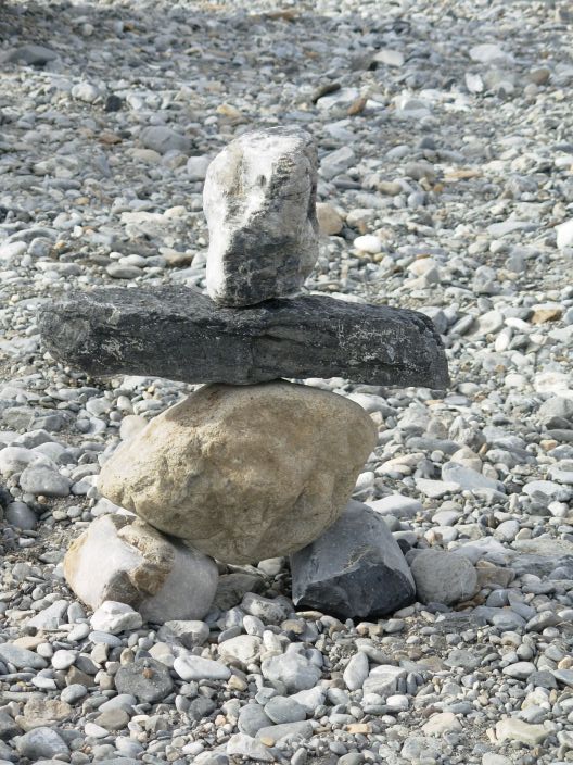
Rock statue. By John Walker.
.....................................................................................................
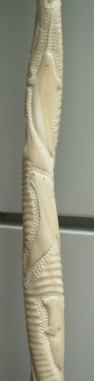
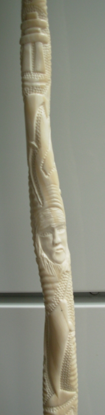
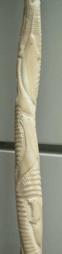
Carved Narwal Tusk, 1.3 m. [1]
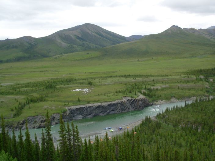
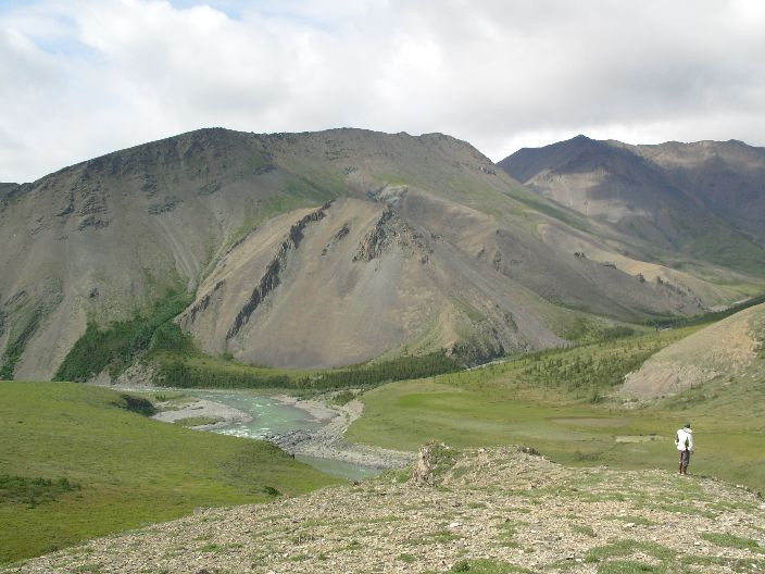
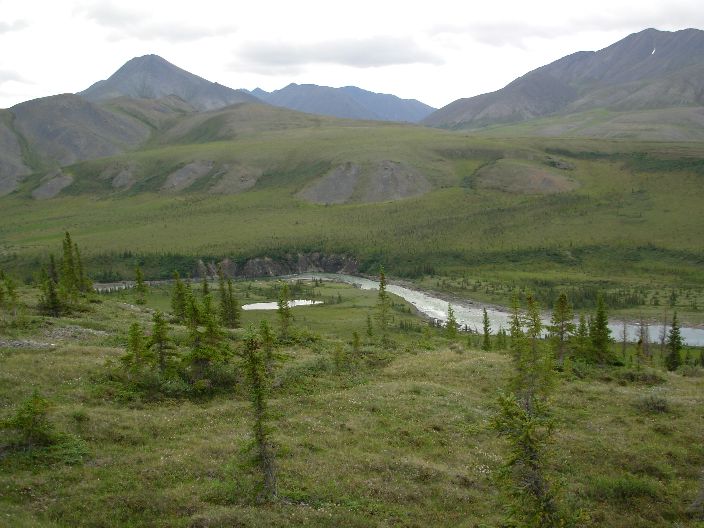
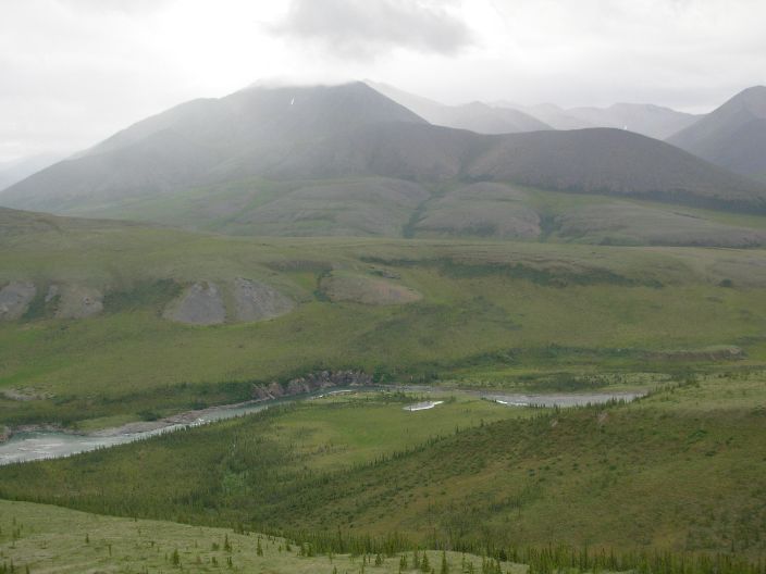
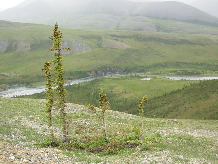
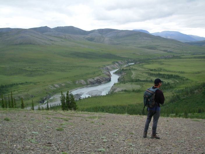
Firth River near Margaret Lake, start of the rafting trip, view to the NE.
The Arctic is the last true, vast wilderness on Earth. It is protected by a hostile climate and very little to live off. The indigenous hunter-gatherers used to live here in small bands, spread over a huge area given the lack of food.
In Alaska and Northern Canada few people except the natives, have the right mindset to live here. There are a large number of city dreamers who would like to live in and off the pristine land year round. Of those who tried, few managed to survive and stay for more than a few months, see the book by Krakauer, “Into the wild”. They do not realize that true nature is very harsh and selective. It requires the right balance in knowledge, intelligence and physical strength with an additional emotional endurance.
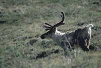
Porcupine Caribou, after [1].
The last time I visited Arctic Canada was in 1989, see [1], the last of five expeditions of two months each to Ellesmere Island.
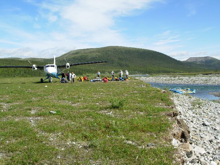
Ian Cumming from Vancouver, with whom I did a trek in the Everest Region in 1997, urged me to join his rafting party in the Yukon. They needed a 12th person for the Firth River rafting trip in July 2006 and this is considered an ultimate Arctic wild life experience on the Canadian side of the famous Arctic National Wildlife Refuge (ANWR) in NE Alaska.
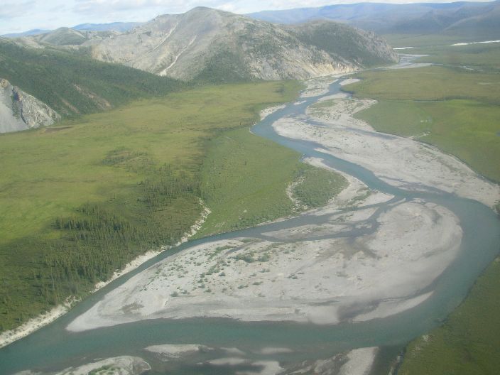
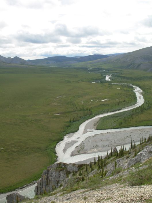
The Firth River is some 120 km long and runs NNE across the Eastern edge of the Brooks Ranges, here called the British Mountains. We would pick up the river where it enters the Canadian side of the ANWR, in the Ivvavik National park [1] [2], 250 km NW of Inuvik, the main access town in the region. The Firth River flows into the Arctic Ocean and we would also visit the nearby Herschel Island, with an American whaling station from the 19th century. A privately chartered Twin Otter plane transports us to and from the field.
Parks like the ANWR/Ivvavik are the last vast and true wilderness regions on earth, (almost) untouched by human beings as in this area there are very few human settlements, see description.
Here animals do not really know modern man and still react very natural, keeping a safe distance. We look very big walking upright and with a strange, unknown scent are treated with caution. Wolves and even bears keep a respectful distance.
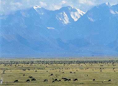
This area is the home of the Porcupine Caribou Herd [1] with some 125,000 animals. In the summer they calve on the wind swept Arctic Coastal plains ideal for good grazing during the short summer and hardly any natural enemies like wolves and bears. In the winter they stay in the forest around the Porcupine River near Old Crow [1].
Twenty to thirty percent of the undiscovered oil and gas resources of the USA are below the coastal plains of the ANWR and the current president of the USA is keen to recover those but opinions differ widely, see e.g. a summary on the National Geographic Website or the May 2006 issue of National Geographic [1] [2] [3] [4] [5] [6] [7] [8] [9] [10] [11] [12] [13] [14] [15]
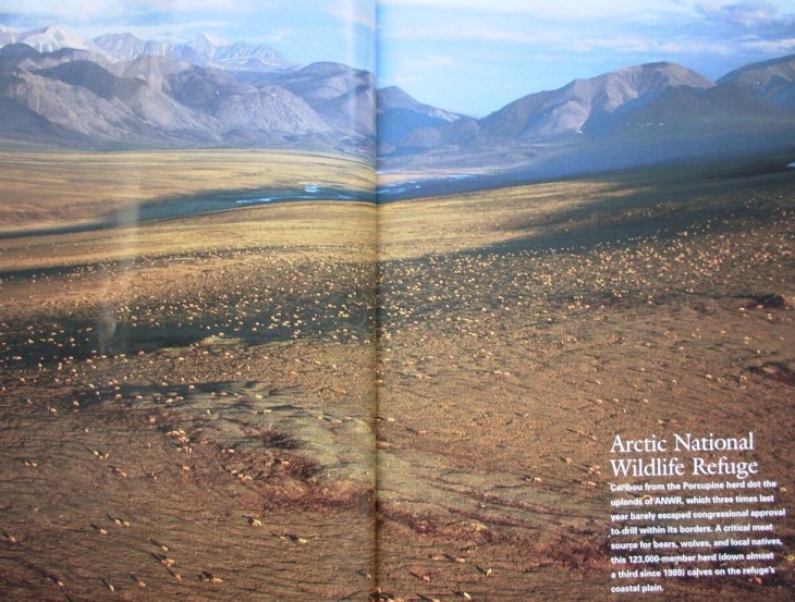
Porcupine Caribou Herd in the ANWR. After National Geographic, May 2006.
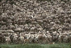
Porcupine Caribou Herd in the ANWR.
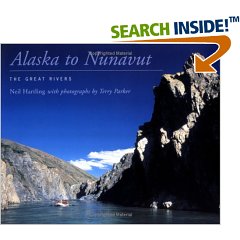
Rafting and canoeing is very popular in this area. Ten rivers including the Firth River, are described in the book by Neil Hartling.
Map of North-West Canada. After Neil Hartling. "Alaska to Nunavut. The Great Rivers."
The Firth River. After Neil Hartling. “Alaska to Nunavut. The Great Rivers.”
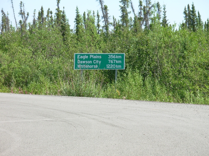
Population 3000, 100 km South of the Arctic Ocean on the East arm of the Mackenzie River. 23 C at 30 m altitude on 14 July.
Yesterday we took a 748 from Whitehorse (pop. 20000) to Inuvik with Air North and stopped in legendary places, Dawson City (pop. 1500) and Old Crow (pop. 300) on the Porcupine River [100 meter wide river][Village][Airport with the 748] [Airport with Ian], the winter habitat of the Porcupine Caribou Herd [1].
Inuvik seems very disappointing, just a single street and modern buildings but the museum has an impressive list of things to do [1], including the large swimming pool with a water slide and sauna.
We meet several Palestians that have jobs like taxi drivers, hairdresser, and a waiter in a lunch room. How do they end up here?
Today it is 23 C and it feels very warm. We take a 2 km walk around a lake surrounded by low bush and black spruce trees, and are attacked by numerous mosquitoes. DEET 50% works well to chase them off, they land but take off right away.
Figo at the South side is a large bar with good food. Here we meet our three guides again at night and a waitress from Halifax, a young girl leaving soon after a disappointing 10 months, with a 'Mad about the boy' experience. She called us the only normal people in the bar, the locals being too demanding. Being blond, young and good looking, could be a handicap with so many single males in town. She is very happy with the 5 Euro tip and may remember us when we come back.
On the way to the pub I was badly bitten by a black fly in my neck to my surprise as I did not notice it. The small wound is swollen and bleeding and will itch and for the next few days.
The Parks Canada Office has good information on the various national parks in the region. For the Firth River, there is a waterproof booklet covering the full 120 km in detail, including several hikes of 2-6 h. We also said “Hello” from Linda, the Parks Canada guide from the SS Klondike in Whitehorse, a historic site with a steam paddle boat in service on the Yukon River from 1900 to 1950. Last year Linda worked in Inuvik.
Distance from Inuvik to Dawson City and Whitehorse
New equipment this year is a very comfortable, inflatable mattress, "Downmat" from Exped distributed by Mountain Research, a medium size foam pillow from Thermarest, several waterproof stuff bags and a Fjallraven water repellent and wind proof cold weather pants. The mattress was a last minute purchase at the giant Mountain Equipment Coop store in Vancouver.
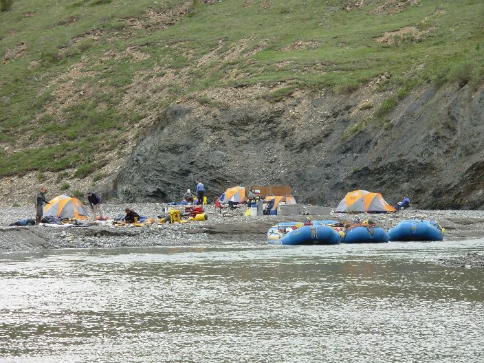
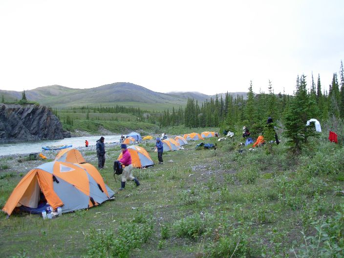
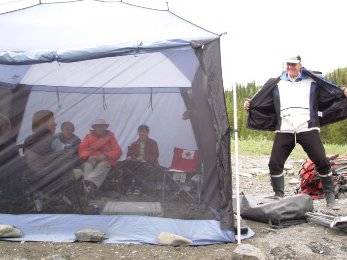
Camping in the Ivvavik National Park is different from other parks. We try not to leave traces of human odours to avoid grizzly bears are attracted to the camp sites. We should not pee in the bushes around the camp but in the river or in the portable outhouse. All the dish water is also thrown in the river. The garbage and even the poop box of the portable outhouse is taken out, the latter accumulating to four aluminum containers of some 30 kg each after a 12 day trip.

Portable toilet on the Firth
River at the Margaret Lake camp.
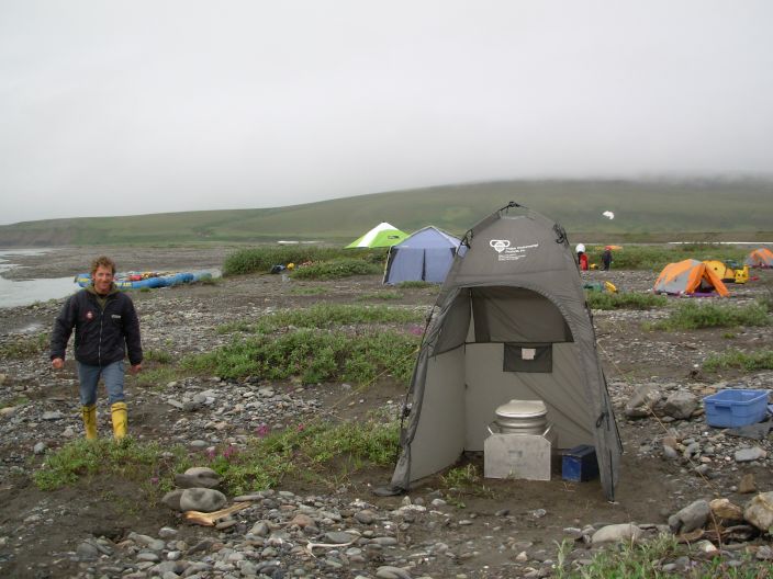
Portable
toilet on the Firth River past the Cut Bank Creek camp.
Twin Otter on the Margaret Lake landing strip, Firth River and rafts on the right.
18 C at 400 m altitude. Very windy.
The plane will leave at mid-day and we are suppose to be ready at 11 PM. Ian is not ready and getting frantic in the packing so I decide to buy a breakfast in the supermarket to create some extra packing time as he is normally slow. We are spot on time but the bus is 5 minutes early. Ian gets applause as he is normally 10-15 minutes late.
The Twin Otter plane takes us in 1 hour and 15 minutes to Margaret Lake, a distance of 250 km [group in the plane]. The first half hour we fly over the vast Mackenzie Delta, endless clear lakes and narrow meandering brown streams with very slow flowing water, only 40% land with low bush dotted with small black spruce trees [1] [2]. The only animals we see are snow geese, white specs on the lakes.
The landscape changes abruptly into brown, barren rolling hills and finally into the 400-600 m high ridges of the British Mountains. The wind is strong and flying low for our tourist flight, the plane rocks like a boat. We try to spot caribous but we see none, neither other animals. The caribous could now be on the Arctic plains in the ANWR, 200 to 300 km to the NW, their summer habitat for calving and feeding, see the tracking website [1].
We land on a large grassy spot next to the Firth River, a relatively soft landing for a wilderness landing. The grassy landing strip [1] is marked with a few orange pylons.
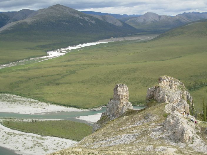
After setting up the camp [1], we go for a 3 hour hike up the mountain marked on the map. The landscape is vast and empty, no animals to see apart from the numerous ground squirrels (as abundant as lemmings on Ellesmere Island) but there is evidence of the presence of grizzly bears from bear scat [1]
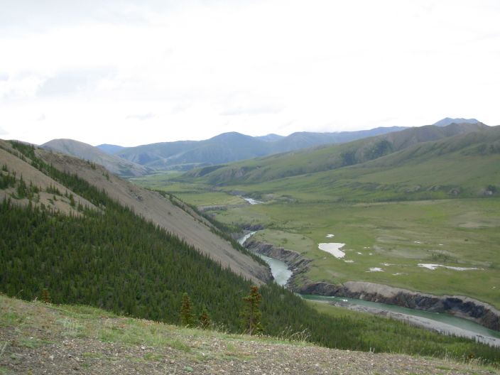
In the far distance the valley of the Firth upstream is covered with Aufeis [1], a large area of white ice lit by the Southern sun. Aufeis is formed in the winter by water coming up from artesian springs, floating to the top and freezing, forming a dam of ice blocking the water. Behind the ice there is a large gravel plain typical for an empty lake.
Afeis on a side creek of the Firth River, view from the hill near Muskeq Creek.
18 C. 2 hours on the water.
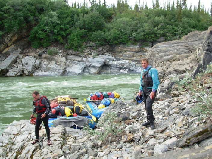
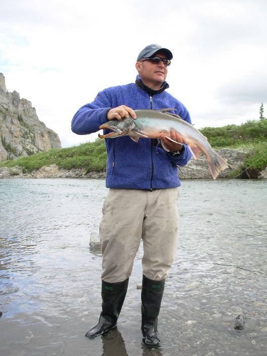
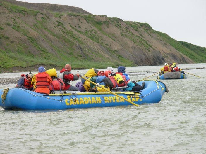
We have a very slow morning, as we need to get used to packing of tents and personal gear, and fixing the large volume of luggage on the rafts [1]. We leave at 11 AM and stop twice for fishing. At the Muskeg Mouth camp site we catch 3 Arctic Chars, the biggest 7-10 pounds. They will all be cooked for dinner tonight, 15 hungry mouths to feed.
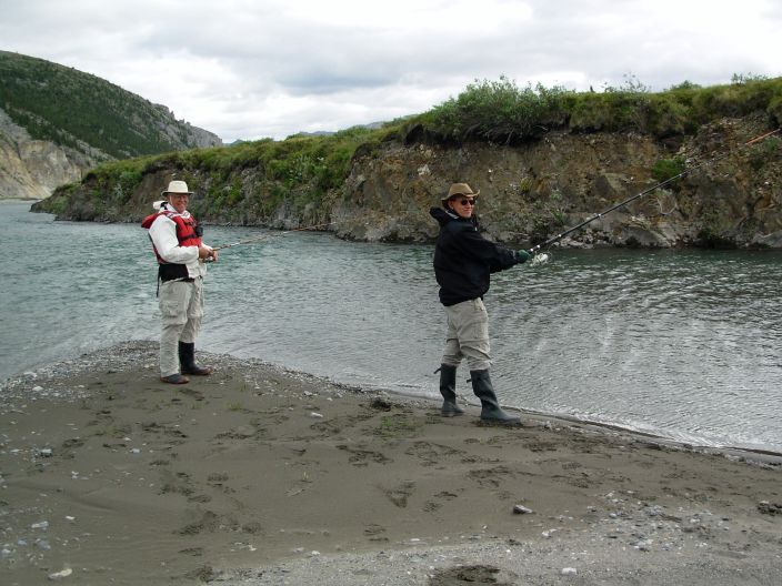
Dennis and Jean
fishing at Muskeq Creek.
Rafts at Margaret Lake.
Ritch with an Arctic Char caught by
Dave.
Muskeq
Creek
We walk up the mountain near the Muskeq Creek campsite and have excellent views at the vast and empty landscape.
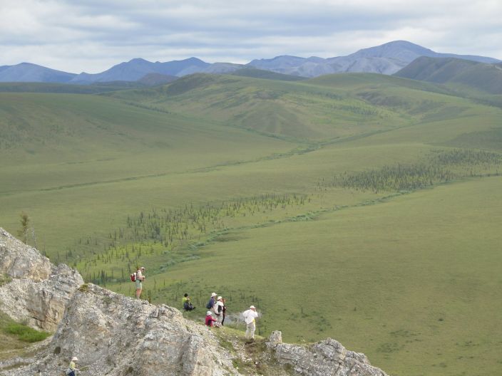
View from the mountain next to Muskeq Creek
Tonight it is very quiet, bright sunshine at 11 PM. No wind, rustling sound of the river and in the distance I hear snow geese. The air matress is very comfortable, I can easily turn on my right side as if on a normal bed. Only the pumping of the mattress using the stuff bag is slow, it takes around seven minutes and 30 full bags of air to blow it up.
18 C, rain after 6 PM, 3.5 h rafting.
A relatively slow drift on the water. Fishing is poor. Dennis caught a small Greyling fish.
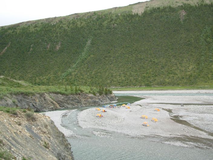
The Joe’s Creek camp is on a gravel bar, only 20-30 cm above the current water level. In the side creek of Joe's Creek, there is a wolf den along the long hiking route but we decide to take only the short route up the hill near the camp.
Heavy rain with strong wind starts at 6 PM. It keeps on raining all night, mostly light. The hamburgers get soggy in the open, and after setting up the bug tent we have trouble to keep it from not blowing away. Four long ropes keep it in place until the wind goes down an hour later.
The weather in this area does change quickly, one hour it is nice and sunny, 18 C, the next hour there is heavy rain with strong wind, 12 C.
Sheila showed me an interesting book by Ed Struzik. "Ten Rivers", with personal adventures on 10 rafting/canoe rivers in the Canadian Arctic (NWT and the Yukon) including the Firth River. The river on Banks Island, NE of Inuvik, with its 20,000 musk-oxs looks very inviting.
Joe Creek Camp
Site
Joe Creek
CampSite, detail
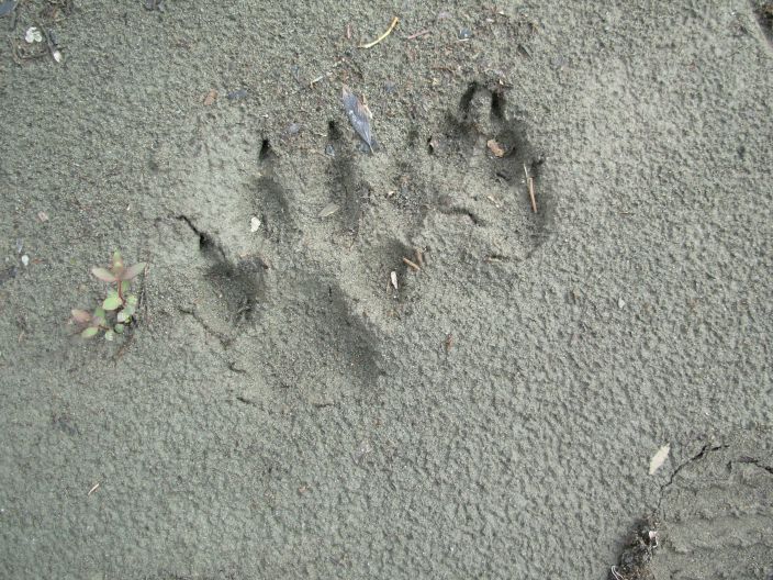
Wolf tracks
18 C, 2.5 h rafting, mountain range starts, 1200-1300 m elevation, highest 1680 m. Rain 4-6 PM.
Lots of class 1 rapids today, even one class 3 and one class 4. Only high rubber pants with straps keep you dry, all other give wet bottoms, especially if you have side pockets, and ... I hate wet briefs! The solution is simple, tape up the pockets with duct tape. Gortex pants yesterday were even worse, the wet seats of the rubber raft penetrate the pants.
Shot good videos of the class 3 and 4 rapids of the Sheep Slot Rapids where only the guides were in the boat and it was too tricky for us, also as the boat would heavier.
With forest in the deep valleys, this is grizzly bear country. We see bear scats, dug up ground squirrel dens and scratched trees, clear signs they are around. There are also several major caribou trails.
Bathing is very good in the relatively warm (12 C) pools along the river.
Firth River at the Wolf Creek South Ridge Hike, upstream
Firth River at the Wolf Creek South Ridge Hike, upstream
Firth River at the Wolf Creek South Ridge Hike, downstream
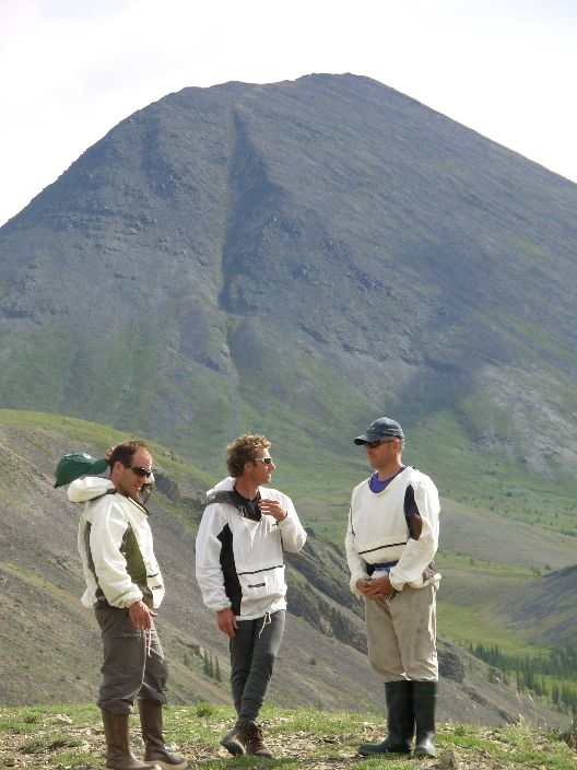
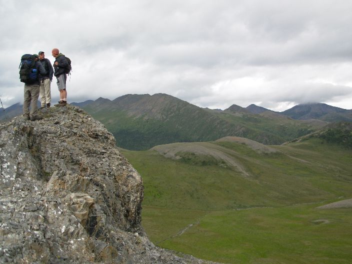
Ritch, Steve and Mike at the Eagle Ridge Hike.
Hike of 4 hours. Last 45 minutes heavy rain. Nearby 1365 m mountain not climbed, looked inviting.
Walked up the Wolfs Tors, 400 m vertical elevation, and had luch here [1]. Nice view at the highest mountain of the area, 1680 meter [1].
Rain from 3.30 to 9 pm. 14 C. We had rain in the late afternoon for the last 3 days.
There are 4000 wolves in the Yukon, an area the size of France. Their territory is 600 square km in the winter and 1000 square km in the summer. The average life of a wolf is only 3-4 years. A 12 year old wolf is very old.
Dennis spotted our first caribou while he was fishing downstream. It swam across the Firth River going East, shook itself dry, looked for 10 seconds at us and started running. I tried the telezoom lens for a shot but had it set to macro for Ian’s flowers and the image is out of focus. Could this be the only caribou on our trip?
A ground squirrel [1] nibbled at the toe of Della's new rubber boots, now she has an annoying leak.
Highest mountain along the river, has no name, 1680 m. Right side.
Ritch, Steve and Mike at the Wolf Tors.
Wolf Tors Camp Site, rain starting.
Wolf Tors Camp Site, with trees.
2 hours in the boat, passed the only ranger station in the park. Used to be a gold placer mining site in the early eighties.
One difficult rapid with a big rock, called Sheep Slot. The guides spent a lot of time studying it and decide to we cannot stay in the boat. See downloabable videos above.
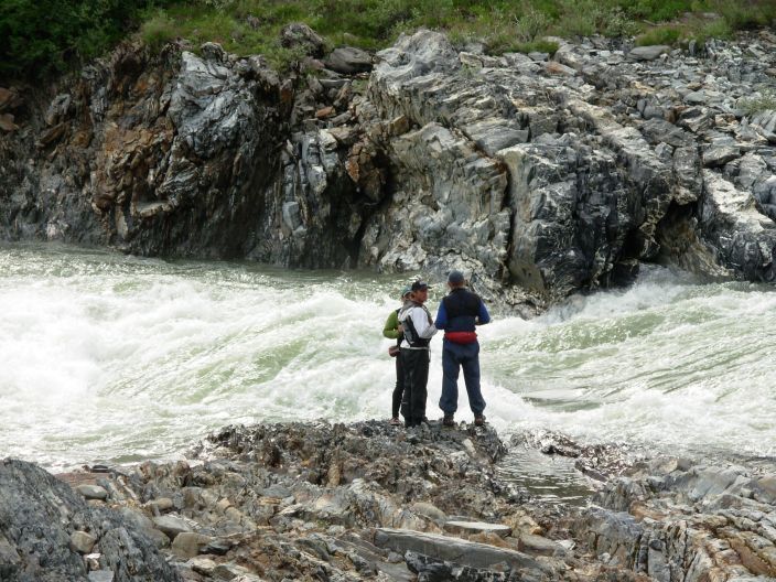
Sheep Slot rapids, class IV
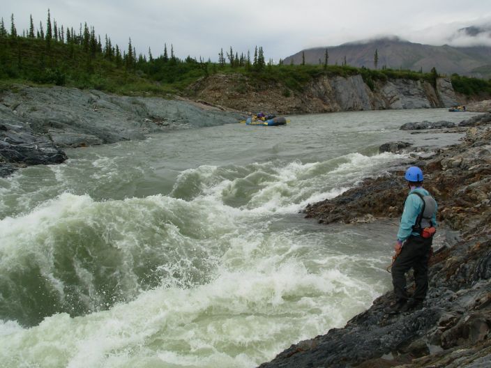
Sheep Slot rapids, class IV
Mike and Steve after battling the Sheep Slot rapids.
No rain from the South today, big surprise. Did we reach the 110 mm per year limit over the past few days? Wind shifted from the S to the N.
Red Hill campsite
Walk. 5 hours, 7 km, 500 m up. 12 C. Rain 3.30 to 7 PM.
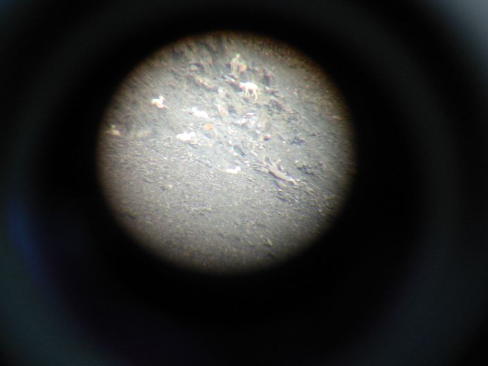
Dal Sheep on the steep mountain near the camp, zoomed macro shot of the telescope viewer worked [1].
Rain with storm gust, for 2.5 h. Meindl Borneo hiking boots are almost dry, only a bit wet at the flaps. The greasing this morning worked well.
Rain starts at 8.30, all day till 17 h. 8 C.
Today it feels cold. No wind. We do not dare to go into the woods for more than 300 m to look for flowers, Eight years ago, on his last visit, Steve spotted a grizzly bear in this valley.
Dal Sheep at Red Hills Campsite (macro shot of the telescope viewer)
Firth River, South
of Red Hills
Firth
River, North of Red Hills
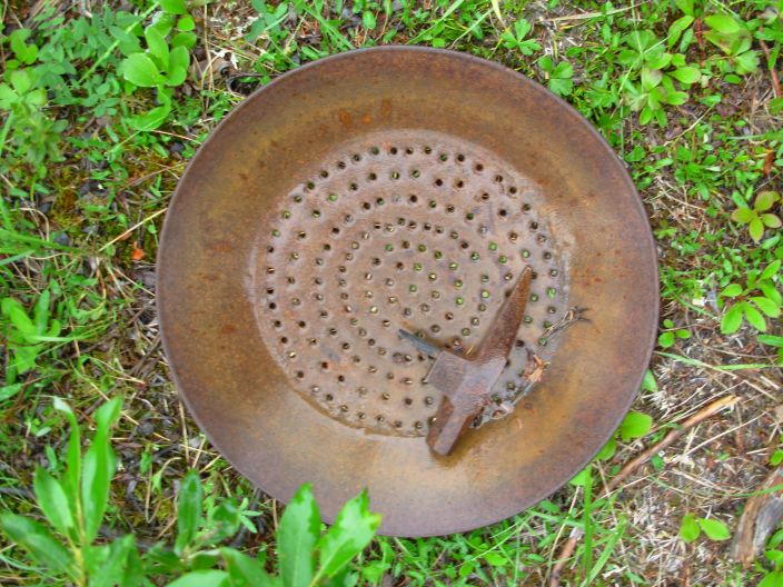
Gold pan
and prospectors pick
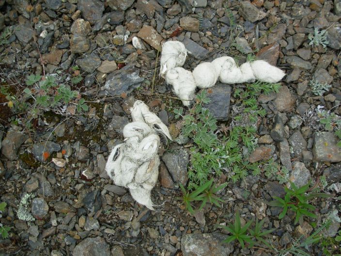
Wolf scat
Ritch in the storm
Us
in the storm
Strong, wet wind on
the ridge above the Red Hills camp site.
Drying
wet clothes after the wet hike.
"Dirty
man" in camp
Long day, 4 h on the water, 18 C. Light rain starting at 10 PM. Several of us get their feet and bottoms wet. My taped up pant pockets work fine.
Lots of rapids, also a rollercoaster, class 4. Boat ride is cold, fully dressed up.
Kaka sound of a white bird is possibly a Gyer Falcon.
Finally at a lone hill, “Engigstciak”, view of the Arctic plains. Low rolling hills, barren, view for some 50 km. With 8x32 binoculars I cannot spot any animals for miles. The numerous mosquitoes are blown off by the wind. In the far distance we see a radar tower of the DEW line, the early warning system against Russian missiles with stations every few hundred km along the 70 degree lattitude in North America.
Washing fine in pools near the river, temperature 12 C. Bear tracks [1] in the camp could be a month old.
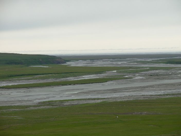
Arctic Plain on the Firth River.
John's rocks in socks camp (for drying outside and so they do not blow away in the strong wind).
6 hours on the water. 15 C. Started with dark skies, clear at 6 PM. Strong ESE wind.
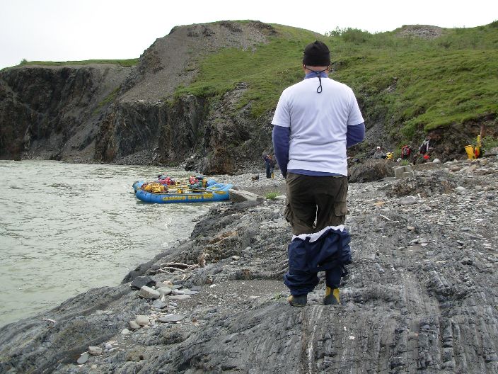
After one hour many shallows in the delta. Boats need 40 cm to float, lots of spots with only 20 or 30 cm, pushing and pulling in hip waders [1]. Big piece of flat ice between the meandering stream, blue so old ice, probably last years. Many of us get wet inside the hip waders, getting in and out of the boat all the time.
Around 3 PM we arrive at the delta during high tide. In the distance we see a square feature on the coast, a log cabin from the 1930's, near our camp site and we use it as a marker. Four curious caribous approach us and run off again.[1].
Another hour to cross the lagoon to the spit. Finally get the outboard engine to work, ... after filling with gasoline.
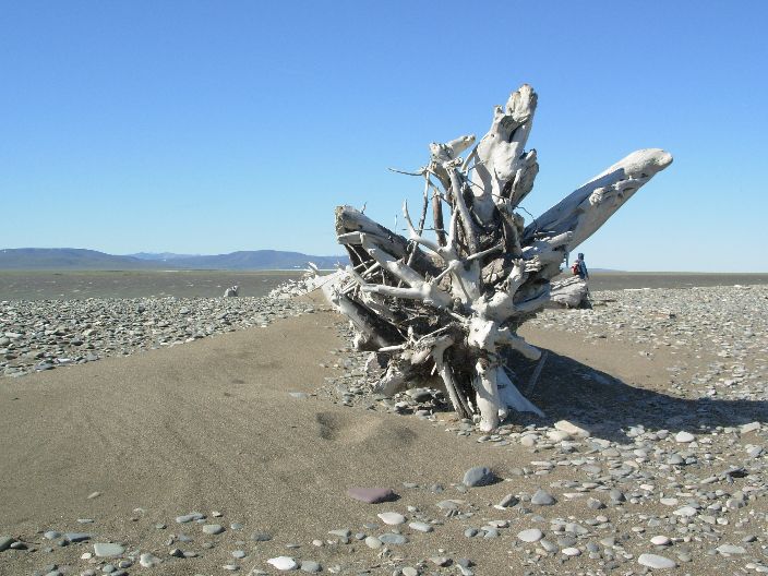
The spit is full of drift wood with tree trunks of up to 10 m long [1]. This is used to build walls as tent shelters against the strong Arctic winds.
This camp feels like the real Arctic, sunny and strong winds, except 15 C is a bit warm.
Sheila jumps in the Arctic Ocean, water is not so cold, 5 C [1].
We set up a raft as wind shelter [1].
Raft in shallow water of the delta..
Firth River delta and mirages
of icebergs.
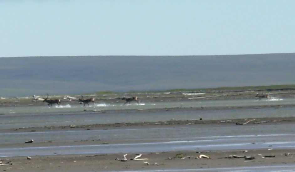
Caribous in the Firth River delta.
Sheila in the Arctic Ocean.
Sheila on the beach of the Arctic
Ocean
Raft as wind shelter
on the spit.
Temp 15 C, blue skies with strong wind from 12 - 20 h, 70 km per hour, sand blowing in the tent. Only wooden stakes of drift wood are big enough to tie down the tent. Air is salty and dry. Sun set at 3.24 h [1] at this location, 69 degrees and 55 minutes North [2], and still 25% sun visible.
Picture taken of sunset/rise: at 2.48 h, 3.19 h, 3.23 h [1] , 3.24.30 h
Arctic Stern defending its nest [1] [2] .
Entrance lagoon has 200 small birds ( Phalarope [1]) picking for foot in the water and here the water flows into the ocean.
Here also an Innuit camp with tent poles and a zodiac with a fishing net.

Arctic Stern and coastal mountain
range
Ritch, Steve and Mike at the Spit
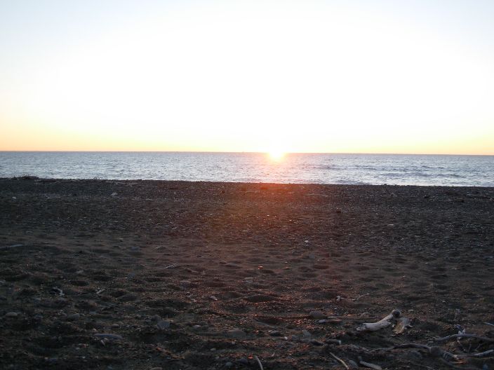
Midnight sun: sunset and sunrise at
3.24 AM Inuvik time.
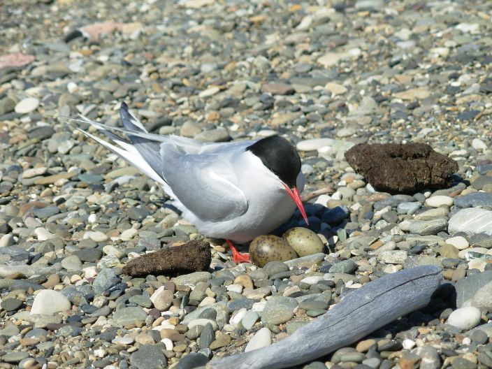
Arctic Tern with nest and eggs on the
Spit
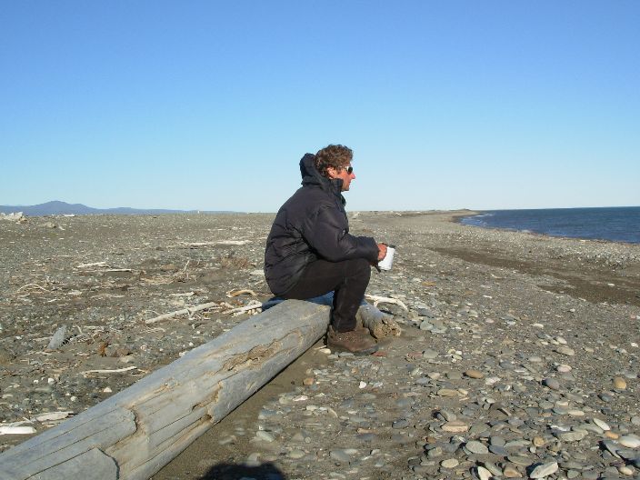
Steve on a trunk staring in the
distance of the Arctic Ocean

Jean on a trunk staring at the Arctic Ocean, next to a whale vertebrate.
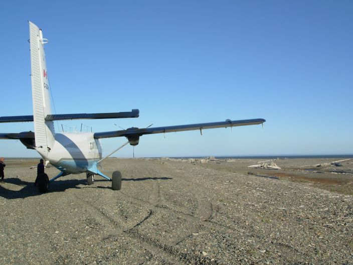
Twin Otter on the landing
strip of the spit
19 C, moderate wind. Plane pick up at 10 AM. 1 h 20 m to Inuvik.
The Twin Otter landed on the gravel bar along the coast [1] this morning and we are now flying along the coast of the Arctic Ocean. I see two caribou herds of some 20 animals each on Herschel Island which has an old American whaling station from a century ago.
I am staring out the window and in the MacKenzie Delta. My fingers are still sensitive from pulling the raft through the shallow river delta two days ago. I finally see my first moose standing in one of many lakes, only 40% of the delta is land. Kms long, very straight seismic lines crosscut land and lakes, created in the winter on the ice.
People have been in this area for 15,000 years and the warm summers explain this. The area is has been touched but now almost all have left, most of the Innuits, whalers, prospectors and DEW line stations crew.
The oil industry may be here soon. In the 1850s, whalers were astounded when they ran out of customers for oil before they ran out of whales, a few years after the first oil well was drilled by Drake in August, 1859. The Herschel Island whaling station was active for a short period only, from 1891 to 1898. By 1910, whaling in the Arctic was not profitable any more. The whales are still recovering. Will the oil industry run out of out of customers before they run out of oil? The stone age did.
This was a unique trip, with very capable guides. Thanks Ritch, Steve and Mike. Only (tiny) criticism, no hot water for washing in the tent in the morning like the Sherpa's do in Nepal.
Photos
Photos from Ian (Select Firth River)
Downloable
zip file with photos from Jean (100 photographs, 11.6 MByte).
Movies
Downloable movies (Very slow loading
on-line (3-50 minutes), save to file first, and play later: Select,
Right Click Mouse, Save Target As. Size in MByte.
In Apple Quick
Time format (.MOV), see
http://www.apple.com/quicktime/download/win.html to download the
Quick Time movie player for Windows XP:
Mariage
ceremony Sheila and John (68 MByte)
Birthday
Steve (5 minutes, 176 MByte))
Ritch
in the sluice (17 MByte)
Mike in the Sluice (18
MByte)
Steve in the Sluice (21
MByte)
Sheep Slot Rapids(16
MByte)
Instructions by Ritch(129)
Ritch in the Sheep Slot
Rapids(39 MByte)
Steve in the Sheep Slot
Rapids(42 MByte)
Mike in the Sheep Slot Rapids(44
MByte)
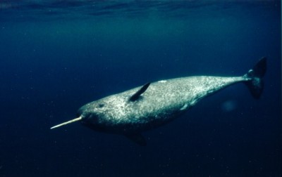
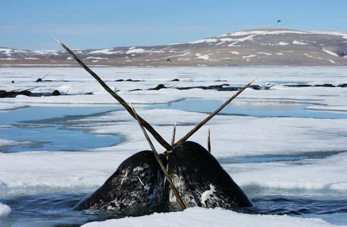
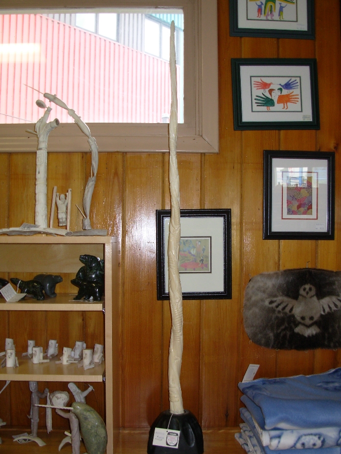
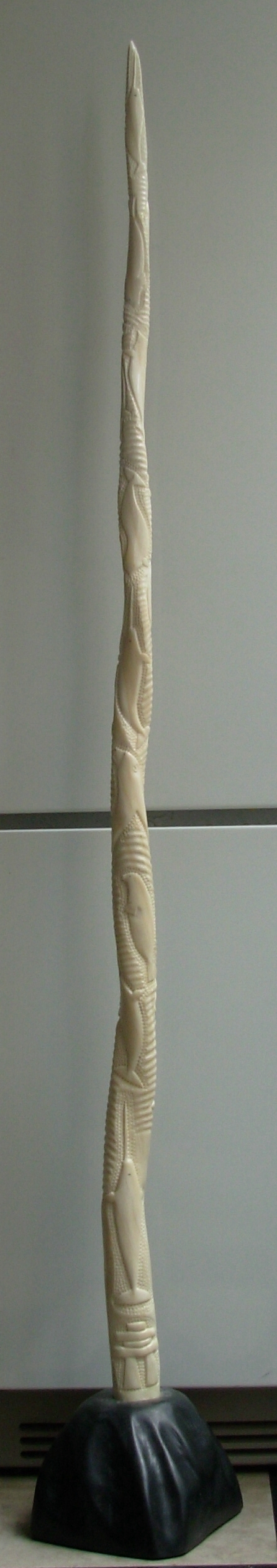
Narwal, up to 6 m long whale.
Tusk is up to 2.7 m long, see description [1].
Picture after: Ocean
Quest Gallery
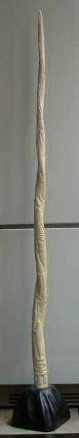
Narwal Tusk in the Inuit craft store of Inuvik (130 cm).
Inuit craft store of Inuvik, Innuit shopkeeper packing.
Front Narwal Tusk (0.6 MByte) for viewing detailled carvings.
Back Narwal Tusk (0.6 MByte) for viewing detailled carvings.
Narwal Tusk, details below.
Narwhal (narwal) pictures by Paul Nicklen, also see [1]
Narwhals
in ice holes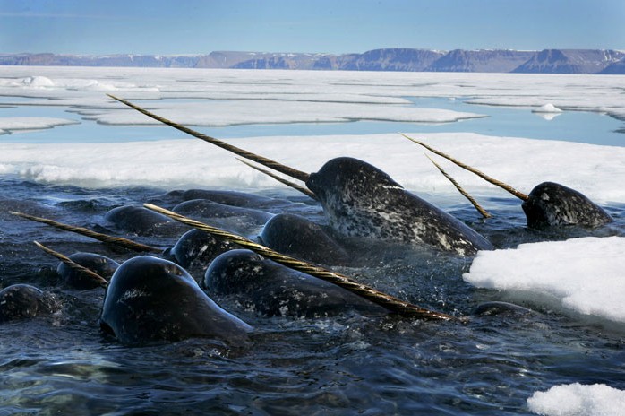
Narwhals
in ice holes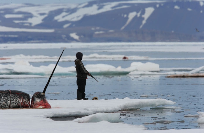
Shot
Narwhal with hunter waiting for passing Narwhals

![[1]](06yu0773donna.jpg)
![[2]](06yu0774donna.jpg)
![[1]](06yu1403narwhalfull.jpg)
![[1]](06yu0316porcupine.jpg)
![[1]](06yu1236ng.jpg)
![[2]](06yu1238ng.jpg)
![[3]](06yu1239ng.jpg)
![[4]](06yu1240ng.jpg)
![[5]](06yu1241ng.jpg)
![[6]](06yu1242ng.jpg)
![[7]](06yu1244ng.jpg)
![[8]](06yu1245ng.jpg)
![[9]](06yu1246ng.jpg)
![[10]](06yu1247ng.jpg)
![[11]](06yu1248ng.jpg)
![[12]](06yu1249ng.jpg)
![[13]](06yu1250ng.jpg)
![[14]](06yu1251ng.jpg)
![[15]](06yu1253ng.jpg)
![[Village]](06yu0307oldcrow.jpg)
![[Airport with the 748]](06yu0311oldcrow.jpg)
![[Airport with Ian]](06yu0310oldcrowian.jpg)
![[1]](06yu1169things.jpg)
![[group in the plane]](06yu5540iangroupplane.jpg)
![[1]](06yu0378delta.jpg)
![[2]](06yu0374makkenziewest.jpg)
![[1]](06yu0408margaretlake.jpg)
![[1]](06yu0424bearscat.jpg)
![[1]](06yu0416aufeis.jpg)
![[1]](06yu0397margaretlake.jpg)
![[1]](06yu0649groupatwolftors.jpg)
![[1]](06yu0644mountainwolftors.jpg)
![[1]](06yu0628groundsquirrel.jpg)
![[1]](06yu0962beartrack.jpg)
![[1]](06yu0977shallowwater.jpg)
![[1].](06yu1016oceansheila.jpg)
![[1]](06yu1027spitshelter.jpg)
![[1]](06yu1032midnightsungarmin.jpg)
![[2]](06yu1033spitlocation.jpg)
![[1]](06yu1064phalarope.jpg)