To the Canadian High Arctic
Table of Contents of "To the Canadian High Arctic"
*
To the Arctic polar region
Travelling to the highest Polar region of northern Canada is a privilege only a scientist has [1]. I started a research job with the University of Toronto in 1981 with the opportunity of doing two-month field trips to Axel Heiberg Island and Ellesmere Island, east of Northern Greenland. This region is at the same latitude as Spitsbergen. For a history of this region see:
http://www.arctictravel.com/chapters/historypage.html
Axel Heiberg Island at 79-81 degrees latitude has the same size as Switzerland, rough 300 by 150 km, a population of zero people and a single simple cabin near the 10 km wide Thompson Glacier [1] owned by McGill University of Montreal. Ellesmere has the size of England with only 3 small hamlets: Grise Fiord on the South coast with some 200 Inuits, the weather station Eureka[1][2] with a population 10 in the winter and more, up to 50, in the summer, and Alert, the Canadian Army base for training commandos. Ward Hunts Island at the north side of Ellesmere Island is the starting point for the 800-km trip to the North Pole.
The summer fieldwork season is from late June to late August when the temperature is 1-4 degrees Celsius at sea level, colder in the mountains and near glaciers. Summer lasts perhaps for 1 week with temperature of 8 degrees Celsius, called T-shirt weather, but you can be ensured of a snowstorm, right after the nice summer week. The sun is at an angle of 30 degrees to the South at noon and 20 degrees to the North at midnight, giving a feeling of a permanent sun position of 4-6 PM in the afternoon. To force a feeling of night and protect my eyes I used sunglasses after 6 PM. The compass needle points 270 West as the magnetic North Pole is only 200-300 km North of Resolute Bay on Cornwallis Island and is unreliable getting interference from solar magnetic storms combined with a weak field.
Canadian Airlines has two-weekly flights from Montreal or Edmonton to Resolute Bay on Cornwallis Island, the main government base [1] for supporting scientists in a region within a radius of almost 1000 km, spanning the entire Queen Elizabeth Islands. The flight to Resolute Bay takes 6 hours, stopping over in Iqualuit, the former Frobisher Bay [1][2], now the capital of the Eastern Inuit Province. Resolute Bay has a gravel run way where specially adapted Boeing 737 passenger planes can land. The Boeing 737 carries half passengers and half freight. Safety rules were very strict. E.g. scissors and pocket knifes were strictly prohibited to carry as hand luggage. However, checking in three shot guns and a large box with 300 rounds of 12 gauge ammunition as special luggage was no problem as they were put in the cargo hold of the plane.
Resolute Bay [1] [Satelite Image] has a native population of 400 Inuits, imported from Northern Quebec after the Second World War, with a promise of a better life as the sea of Lancaster Sound is rich in fish, Beluga whales and polar bears. The Inuits now live in the standard wooden houses typical of the North, small but with running water and toilets and they live mostly on welfare. The rest of the population consists of temporary workers, possibly up to 200, mainly in the summer, with most staying at the government base [1] and a minority in the airport hotel.
Arriving in June Resolute Bay is still covered in snow and the sea frozen. Further North, there is more land and the temperature is higher. Eureka, the weather station, and Lake Hazen, the only national park allowed to be visited by tourists, are enclosed by Mountain Ranges and form a warm oasis with temperatures of 4-8 degrees Celsius in the summer. This is much warmer than the more common –1 to 2 degrees Celsius.
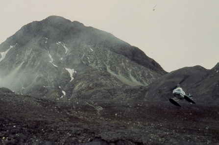
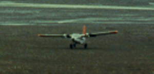
At the government base [1], we sort out the camping gear on loan from the Geological Survey of Canada and the food shipped up from Montreal as airfreight. Within 1 or 2 days we would be taken to the field by a Twin Otter plane with a maximum payload of 3000 pounds that lands in freely picked spots on the tundra using big soft tires [1][2][3][4]. The plane only needs 100 m to land and a straight clear space of 300 m, similar for taking off. The biggest threat is the thawed tundra where the tires would sink in the mud. Pilots look for dry or nearly dry places to land although this is not easy. A stuck plane is a disaster as the only other plane will need to land nearby to pull it out of the mud and this means that for that day none of the two government planes are available. In addition, the common poor flying weather conditions may stop flying for several days.
The weather station of Eureka [1][2] on Mid-western Ellesmere Island at 80-degree latitude was our main support base and here a Bell-206 helicopter [1] stationed for the local camp moves. This takes us to places in the mountains where the Twin Otter planes can’t land.
If there is a serious accident or illness, we have a big problem as the nearest nurse is at a distance of 600 km in Resolute Bay and the nearest doctor in Iqualuit or Yellowknife, 3000 km travel south and some 3 days at the soonest after calling for help. The big scare was acute appendicitis although this is uncommon after the age of 20. Loosing a family member down south could mean missing a funeral and there was one occasion of a biologist who could not return home after his father died.
I spent 2 months in the summer of 1982, 1983, 1984, 1988 and 1989 on Axel Heiberg Island and Ellesmere Island. The camp moves where by helicopter as we had a lot of cold weather equipment, food and research material, over 300 kg. All the travel was done on foot in a radius of up to 10-15 km. Walking on the tundra was variable, muskeg [1] (frost heaved ground surrounded by hexagonal cracks) and loose rocks made the going rough, Crossing streams could be treacherous. As a rule of thumb we used that you could cross a stream up to your knees in the morning using the waist high waders. At night the water level would come to your waist due to the rising sun and you needed the radio mast pole for preventing to tip over by fast-flowing, icy cold water. I fell in an icy-cold small shallow stream once by slipping on a rock and noticed how difficult it is to get up when wearing a packsack as it drags you along in the fast running stream. Luckily I got only half wet and the camp was near.
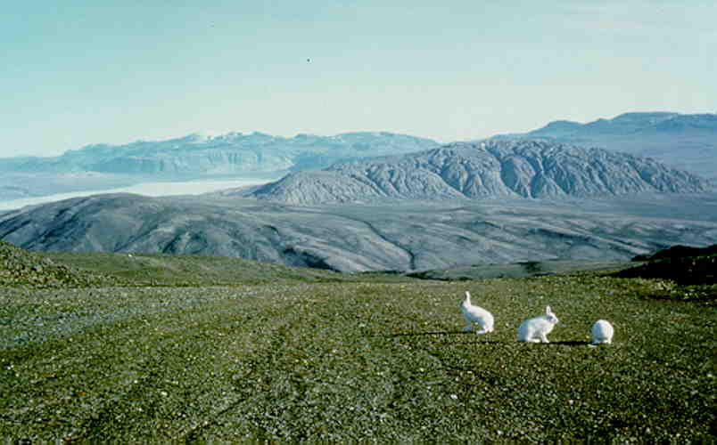
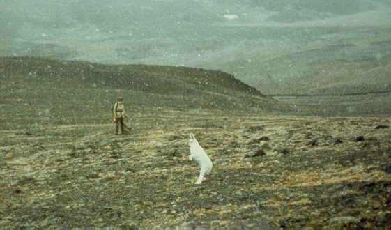
In the pristine, barren landscape you see many white Arctic hares [1][2], several foxes, cariboes [1][2] and muskox herds [1] and occasionally white wolves. The lemming [1][2] is at the base of the food chain for the carnivores and there are zillions if not more. Cariboes tend to approach you [1] as they do not know the scent of human being but quickly run off after sniffing you out [1]. The cariboes were slaughtered by the infamous Peary, the so-called first (white) man to reach the North Pole, a hundred years ago to provide food and fat for his polar expeditions. Sadly, the cariboe herds are still trying to recover. It is now generally accepted that he falsified his logbook, mandatory for proving he reached the pole. He travelling initially at 10-12 km a day which is reasonable but in the last week before reaching the pool suddenly he made 45-50 km which is impossible and his positions determined using a solar compass did not make sense.
Waking up in the morning with a muskox herd [1] of 10-20 animals close to the tent is a unique experience. As soon as they spot you, they quickly run off. Approaching a muskox herd is not without risk. The herd forms a semi-circle and the dominant male stand in front. You can approach them up to 100 meters but when the male starts snoring and its paws dig into the ground you better leave if you do not want to be chased or even put on their horns. Lonely bulls [1] can be approached up to 20 meters. Skeletons of muskox are common and the hard skull preserves best [1][2]. Once I had one student who wanted to be on the picture together while being chased [1] and taking such a risk is totally irresponsible given the long time it takes to reach a hospital.
Luckily I never met any polar bears. As the sea ice does not break up until mid July and there is only little food for them in the region I visited. The biggest threat would be a two year old young polar bear just abandoned by the mother who had trouble finding the good foraging areas and accidentally drifting off into our area. These bears would be spotted easily by planes and helicopters and luckily this was rare. One year I heard a distress call over the radio of archeologists camping near Alexander Fiord on Eastern Ellesmere Island who has several polar bears in the camp. A short focused conversation followed, first "Where is your meat?". We always store this in an aluminum box in a snow bank away from the camp to divert the bear’s attention and this give us a warning signal when it rips open the box. The next question was: "How long can you hold out?" The archeologist answered they were very uncomfortable so in a hurry. A plane was sent to get them out within half a day.
In lemming [1][2] years like in 1989 the number of lemmings is much higher and they are everywhere. E.g. you see tracks and tunnels in the snow [1] and under nearly every rock there seem to be a lemming hiding. I did not witness the so-called mass migrations of Lemmings but there is a theory that they migrate as the grass they eat produces a toxic substance in defense that makes them to wander to other places.
J¬gers, medium size birds, are very common and have nests on the tundra and chase you away when you get too close. Occasionally you see snow owls [1] and very rarely the extremely rare white falcons, called Geier Falcons, [1] that are in high demand in Arab countries. Snow geese are common as well and can serve as a good diner [1] like Arctic hares [1][2].
There are no vertical trees in the area or even small shrubs and the largest living horizontal tree I saw grew on the surface [1].
Within 2 weeks of arriving in the field everyone would get a strong cold that would last for a week. After one or two weeks the temperature of 2-4 degrees Celsius temperature would be bearable but below 2 Celsius you would not get used to the cold and you needed to wear a coat, gloves and woolen hat permanently.
Going home after 8 weeks of fieldwork was always exciting. It started with sitting on chairs on a flat ground, amazing comfort, and the first shower in Eureka or Resolute Bay in the too hot barracks. Being used too much lower temperatures any place warmer than 8 Celsius was too warm. Everyone would have lost significant weight, between 5-10 kg, depending on your overweight. I never really understood why as we had plenty of food eating up to 250 gram of meat per day. It could have been stress due to the uncomfortable camps combined with the sense for survival. E.g., did you ever see overweight wild animals?
Summer of 1982
In the summer of 1982 I visited the Canadian High Arctic for the first time. I was invited by a professor from Toronto to participate in the expedition and he accepted me for a research position mainly based on my farmer’s summer job experiences. "The field work will be no problem for you and Structural Geology I will teach you" was his motto. Turned out that several of his previous students and post-docs had a hard time doing the demanding fieldwork. He now wanted someone with proven experience. I couldn’t believe I got the job. I did hear of one or two students from Amsterdam visiting Central Greenland but this is right next to Northern Greenland on the Arctic Ocean, one of the most remote places on earth.
Our fieldwork team consisted of six persons, two professors, two post-docs (Hervé and myself), and two summer students as field assistants. We would get most of the food and equipment from the Canadian Geological Survey who had a large expedition in the area almost every year and this year they were based in Eureka.
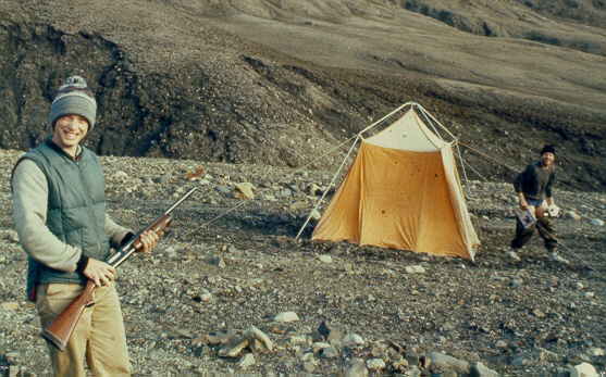
We needed to buy only a few extra pieces of equipment. Firstly, we bought warm down sleeping bags from Blacks that could handle temperatures down to –20 degrees Celsius. Secondly, I got a Firearms Acquisition Certificate from the police station to buy three 12-gauge Remington shotguns with a short barrel in a gun shop, also called riot guns and standard equipment of the police for shootouts or for gangsters for extra firepower. The shotguns used solid lead slug bullets and could kill big animals easily. In our case they served as protection against polar bears and we would carry them around in the field and put them next to our pillow at night, ready to be used, with four bullets in the magazine but none in the chamber for safety. My Dutch girlfriend and a Dutch friend visiting were a bit surprised when I came home and dropped off the three guns and ammunition. For the next few years I kept the guns separated from the bullets, the guns hidden in one closet and the bullets buried somewhere deep down in another closet such that it would take a long time to find the bullets and load the guns. Our professor refused to take them home and the University office did not have a secure storage area. Gun deaths in Canada are mostly accidental caused either by playing with guns or used during family disputes, especially after the long cold winter causing so-called "cabin fever".
At the airport we checked in the three shotguns and box of ammunition with over 300 slug bullets as special luggage and to my surprise this was done in a routine way as if this happened every day. The box with ammunition got a sticker stating "Explosives".
After Montreal we boarded the plane that would take us to Resolute Bay with a stop over in Frobisher Bay, now called Iqualuit. We approached Baffin Island and despite the summer season of middle June the area was covered with patches of snow and the temperature was near freezing. Frobisher Bay is the provincial capital of the recently founded Eastern Inuit Province, "Nunaaavut", of the North West Territories and has only a few thousand inhabitants. The North West Territories cover 50% of Canada, almost the size of Europe, and has less than 50000 people. Frobisher Bay is known for the soapstone artifacts made by the Inuit and Arctic Char fishing. Arctic Chars are of the same family of salmon but have very soft meat, in between trout and salmon, and are considered a delicacy, even more than wild Atlantic salmon. They live in fresh water lakes near the sea but feed in the sea.
The flight from Frobisher Bay to Resolute Bay, the most Northern airport in Canada with scheduled flights, is another 2000 km. In July the sea is still frozen solid and the sea ice had greenish-blue patches, the typical color of old ice that lost its air bubbles. In June the Island is covered with snow and the temperature around freezing. The airport building was a simple barrack and outside you could hear the noise and smell the large diesel engine providing electrical power for the island. Things to see are the small Inuit village, the bar in the airport hotel also frequented by the Inuits, the local grocery store, the archeological sites [1][2] dating back from the warm period during the 14th century when Inuits lived here and the vast barren landscape near the sea. This is polar bear country but I never saw one and the high fence around the base was a clear sign they were around.
We sorted out our equipment and food and waited for an available Twin Otter flight North. This was the high season and the two Twin Otters planes [1] of the government were busy flying scientist to various locations. In the dormitory we met a zoologist specialized in polar bears. He spent a lot of time cleaning and checking his .22 rifle. He told us this was a safer protection than shotguns as it is more accurate but the stopping power is less so you have to aim accurately at the vital parts of the bear, at the shoulder blades but not the hard skull. A zoologist student was meeting up with his professor and they were going to camp on the sea ice for a month to watch whales.
After two days we departed and 600 km further North we tried to land on the open tundra. The preferred valley north of Whitsunday Bay on Eastern Axel Heiberg Island was not possible as the tundra was still muddy, and we settled for an area North of Mokka Fiord [1], passing the huge Mokka Fiord salt dome [1] , where my professor spent 5 weeks in the mid-sixties. We would stay in this camp for two weeks.
In the vast barren landscape you could see for 50 km [1] and using the large-scale 1:62500 aerial photographs was problematic for orientation at first but that they were ever made by the Canadian Air Force in the fifties was remarkable and lucky. For many remote areas in the world like the Karakoram of North Pakistan there are no aerial photographs and in that case you rely on the 1:500000 scale satellite images, without any detail.
One day we did a hike south to check a small salt dome at a distance of 12 km. In the broad valley we spotted a muskox herd. As soon as the herd noticed us the around 12 cows and calves formed a semi-circle and the bull stood in front ready to defend the herd. My professor wanted to take a close up picture and carefully approached the herd but soon the bull started growling and dug in his heels in the ground. At about 20 meters distance he took the picture and thanked the bull. A few seconds later they took off and stormed a hill at a remarkable speed and waited there before taking another leap disappearing in the mountains. These are impressive and very strong animals. Today we walked some 30-km and over 10 hours and my knee started hurting from walking in the rough terrain consisting of loose rocks, mud and muskeg [1]. Very few areas are flat and you mostly walk on uneven terrain.
Hervé and the French professor got bored after a few days and they wanted to visit the big Mokka Fiord salt dome [1], 20 km to the South. They took along a sleeping bag and left for a two-day trip. They made it to the 500m high top and in 1988 I spotted two sets of very clear, European-style hiking boot marks, presumably theirs. At the end of the two days they returned totally exhausted.
After 10 days, the meat was finished and the two students finally got the go ahead to shoot two Arctic Hares, so very common in this area, although we did not have a hunting license. Of course when you need the hares they are gone and it took the students the full night to find and shoot them. Cleaning is a big job, wasting more than half the animal and the remains must also be buried in the frozen ground, the permafrost is only 5 cm deep, as we were not allowed to leave any waste. The meat was cooked for two hours to kill the parasites and make the very tough meat with little fat a bit tender. It was typical wild brown meat, tasty but tough.
After two weeks were moved by helicopter to another camp 12 km to the south and the others went further south to Whitsunday Bay. For the next week in early July we had no contact with the base as solar flares were very active causing a magnetic storm making any communication using the short wave radio impossible. One night the wind grew to storm proportions and the single aluminum tent pole snapped as we put the tent too tight using a lifted pole instead of the stronger double one. The base couldn’t believe it when we asked for a new pole but we spent the night sleeping under tent rattling in the wind, a terrible noise, unable to fix it due to the fierce wind. Here we witnessed the birth of numerous arctic hares hiding by using their camouflage colors [1].
After four weeks we moved to Buchanan Lake [1, area on the sea in the far distance] , a place known for Arctic Char fish. The valley in front of the mountain range was close to the sea and the main north-south pathway for migrating animals. Every day we saw cariboes, muskox and occasionally even wolves passing by. One night we heard animals outside the tent, worried it was a polar bear but luckily there were just two wolves trying to steal our garbage bag. Still, this would have been a disaster as every campsite is inspected after the seasons for trash, as we were not allowed to leave any signs of camping in this pristine natural area. Northern Canada is treated as a highly protected national park as the area is so fragile to human influence. Firing a shot gun did not work and they just looked at us for a brief moment but when I fired an emergency flare they were gone in a split second. This presumably resembles lightning and every animal is scared of flares except polar bears.
The sea ice in the fiords were finally breaking up [1] after some stormy days and we picked up radio traffic between Eureka and the yearly supply boat that was trying to make its way through the ice floats.
A week later, after five weeks of separation Hervé and his student again joined us. When we met them, Hervé wore pajama pants around his long dirty hair resembling a drifter and apparently he didn’t wash for 7 weeks, not even his face, since he left Resolute Bay, much to the disgust of his field assistant. Worse was that he hardly spoke during this period. He kept on saying only three words: "coffee", "cigarettes", "sugar", and stared into the distance with narrow pupils as if he was on dope. He tried to quit smoking over the first few weeks but did not manage. After an urgent plea, the package of cigarettes mailed four weeks ago from Resolute Bay did not arrive until now. They were always out of coffee and sugar as the one package a week was insufficient for Hervé’s need. For Hervé this kind of fieldwork was not his cup of coffee.
I was in great spirits as I accomplished a nice study of the area in the past six weeks and feeling in good shape decided to do a last long trip to the furthest area. We left at 8 AM and returned at 8 AM the next morning. We crossed the Buchanan River waist high and found red shales and burned coal formed by underground coal fires.
The students tried to fish for Arctic Char in Buchanan Lake with a fishing rod but failed claiming there was no fish. They finally caught a big Arctic Char with a geological hammer. The fish was resting in a shallow part of the Buchanan River and they hammered it with the sharp point. We had fish for several days but finally threw out the rest as it was too much and was getting spoiled. Like salmon, the taste is good the first day but the next few days you get sick of it. In pre-20th century Europe salmon was a cheap fish and given to the servants only.
After 8 weeks in mid August a Twin Otter picked us up. It easily landed on the gravel bars of the vast flood plane. It took off using a natural runway of two hundred meters, which is very comfortable. The noise and typical smell of jet fuel indicated we were going back to civilization but after 8 weeks camping in the wild I was very happy is was over.
Summer of 1983
In 1983 the students were Jeff Torance, Jeffy for short, an MSc student, and Steve and Martin, summer students hired as field assistants. We decided to start the work in early June to have two weeks extra, however this was not a good choice as this year spring was late. We tried to land at Whitsunday Bay but after 8 loops the pilot decided against it, "Too wet" he shouted, and "Other camp". I still managed to yell to him "East of the mountain", before collapsing due to airsickness caused by standing up during the sharp loops combined with an acid breakfast of grapefruit. Jeffy took over the orientation and the pilot found a perfect gravel bar for landing. However, not 4 km across the mountain with the salt dome as planned but 8 km further to the east as this was the only good landing site.
Temperatures were freezing in early June, down to minus 7 Celsius at night and this was the first time we needed to use the double sleeping bags. We did not have heating stoves and used the Coleman cooking stoves to keep the tent a bit warm but the carrots and potatoes quickly froze and started rotting after a few days. We did two trips to the salt dome but had to give up, 8 km one-way through snow and mud just to get there was too much energy. The only thing I learned is how to walk for two hours through snow and mud with the least effort by following the leading person breaking the trail.
We decided to look around in the area although we did not have any aerial photographs and I mainly remember the fully covered snow areas [1], the occasional snow blizzard [1] and the students getting bored [1].
After a week we again tried to land at Whitsunday Bay and the now much younger pilot saw no problem although the tundra was still similar, with dry and wet spots. He took one loop and landed while the big soft tires of the plane hit a few rocks during the landing. We spent another week here and our professor was looking at a salt dome with freshly exposed salt, discovered in the previous year. This valley had several lonely muskox bulls [1][2][3]. You could walk around the bulls at a distance of up to 20 m. Steve secretly decided he wanted a picture of a bull chasing him. He planned a spot near gully having soft snow. He would tease the bull and dash of in the gully while Martin would take a picture [1]. Taking such an irresponsible risk is fairly typical of some Canadian students and I wondered why they do not have a better survival instinct. A fatal outcome of the stunt would have been a disaster for our expedition, cost wise as we would have to put up the $10000 for the extra flight and we would be missing a field assistant.
The steep flanks of the Stolz Mountain Range had many steep nearly frozen streams and one day, I wondered "What shall I do, put on protective gloves or take the risk". I found out quickly, after one step and I slid down for 10 meters cutting open the skin on my hand knuckles by sharp ice. This required some bandage and as wounds do not heal easily in the cold climate it was uncomfortable for the next few weeks. I still have numerous small scars.
On the beach south of the camp we spotted polar bear tracks but these could be 10 years old. Steve had a license to shoot ptarmigans[1], which are small pheasant like birds. As a country boy from Ontario he of course tried it, shot off the head of the little bird with the giant slug at close range as a full hit would have exploded the little bird. He cleaned and cooked it but noticed it was hardly worth the effort as he got only a small meal. A few days later, when we ran out of meat and waited for the camp move, he shot a hare and cooked it. I declined but the pilots who landed to move us quickly had a bite when we offered them a piece.
Now in late June, we could move across the mountain range west to Strand Fiord which is much closer to the Arctic ocean where the temperature is colder, mostly close to freezing, with more variation in good (rare) [1] and bad (more common) weather [2]. This year the Geological Survey of Canada had a big base camp [1] on Strand Fiord for 6 weeks with a helicopter stationed. The large kitchen tent was heated which felt like a luxurious camp. However, the camp was always out of cookies and Mars bars and this caused some tension as some students took too many, craving for sugar. The camp was very busy with some 20 persons [1] so Martin and I were quickly dropped in a fly camp south. Martin who had a sweet tooth, was lucky, I do not eat cookies or Mars bars so he got my share as well.
This area is spectacular with mountain ridges of up to 500 meters [1]. July is the height of the summer [1][2] but the pictures look warmer than my memory. We had to cross streams several times and initially tried bare feet but within seconds your feet would be numb as the temperature is near freezing. We quickly requested waist high waders from the base camp so we could cross the streams up to a meter deep.
As the area is colder and I saw very few foxes, hares, wolves, cariboes and muskox but a lot of nesting birds presumably because this cold area is safer. We found a nest with young snow owls [1][2] and once even a nest with white Geier Falcons [1], a very rare bird. J¬gers, medium size birds, had nests in several places and they would try to chase you away if you got too close to their nest. The third camp end of July was in a small, protected valley and here there were hundreds of small young birds called Snow Buntings. Together with the lemmings crawling under the tent floor they could keep you from sleeping for hours by their noise.
On one sunny day we heard that our helicopter nearly crashed by a down draft during a relatively warm day. It was top heavy with 3 people and lots of gear and suddenly dropped a few hundred meters just stopping short of the ground. After this the pilot refused to take a load of over 300 kg and he still looked shaken when he moved us a few days later.
Jeffy and Steve camped north of Strand Fiord and in one camp had a nice view at the very scenic Expedition Fiord area [1] with several ice bergs. Here they got some extra food by shooting an unlucky snow-geese just passing by [1].
After 5 weeks we moved back to the main base camp on Strand Fiord [1]. There was a special tent set up as a sauna by using a heating stove. After spending 30 minutes in the hot tent, the idea was to run the 500 meters to the sea and dive in the –3 Celsius sea water between the ice floats and ice bergs. I declined finding the distance too long and the water a bit cold. The icebergs also provided fresh water scooped out by an empty fuel barrel hanging below a helicopter as the streams were too muddy in the summer.
On the second last day we had to get rid of aviation fuel contaminated by water caused by leaking fuel barrels and the helicopter mechanic invented a game of throwing garbage bags filled with fuel on a fire. This was still not sufficient excitement and soon a flare gunfight started. We were shooting of phosphorous flares above the head of various people hiding, even the camp leader participated. At night during the farewell party, one of the geologists decided that powder snow from a fire extinguisher is also really funny when sprayed inside the large kitchen tent.
The last day we took a group photo [1] characterized by the red colors of the parkas. We boarded the Twin Otter with as many persons as possible, some 14 persons, and this is heavy load. Now the runway used was at least 500 meters and for a few seconds I had the feeling we would not make it. We landed first in Eureka to get extra fuel and Martin and I visited the summer army camp, "Fort Eureka" [1]. Back home I discovered I lost 5 kg over the past 2 months, now weighing only 58 instead of 63 kg, a bit too skinny. "Nice legs but the rest … ., were the comments. For a week I slept for 12 hours a day and had a double food intake. 1983 was a lot more effort than 1982, mainly due to the poor weather.
Summer of 1984
In 1984 Jeffy was going for the second time to complete his MSc Thesis work. Barry Wiseman and (another) Steve (Holysh) were the field assistants. Jeffy was unhappy with Steve but as Steve got a summer scholarship being an A-student and we needed the research money, he was chosen with some grumbling.
I got very well acquainted with Jeffy over the past year. He called our professor, of German descent, Herr Oberst and I was ‘Herr Leutnant". His father was a RCMP officer (Canadian equivalent of the FBI). He really wanted to be an air force pilot. and almost made it in the Air Force Training School but ended up second and would not be flying if he stayed, demoted to a desk job. Geology was his second choice and he loved the Arctic Project as he would be able to do something adventurous resembling a military operation, e.g. he would go close to Alert, the ultimate military training camp on the Northern Tip of Ellesmere Island. Here one of training classes is to spent and sleep (!) a few days outside in the winter at -55 degrees Celsius only using a leantoe (tarp used as wind brake) and sleeping bags. The guns he brought up to the fields were frightening, two accurate high powered riffles able to kill an elephant at a long distance and even a .357 hand gun, probably licensed through daddy. He was also a practical joker and made fun of my lunchbox with the Organic sandwiches with cheese, lettuce and alfalfa (bean spouts). He had the real army stuff for lunch, french-fries with vinegar and hamburger. One day I was eating my lunch, happily chewing till I found out that the stuff was a bit difficult to break up. At the same time there was a roaring laughter outside the room and I quickly found out that Jeffy put small slices of newspaper in my sandwiches.
Barry and I went to the East part of Axel Heiberg and would join Jeffy and Steve two weeks later on the West Coast. My first camp was high up, at 1500 feet, and we soon got covered in 20 cm snow [1][2]. The snow did not melt, as it was a few degrees colder this high up compared to see level. This was not a good start although the petrified wood pieces in a well-known location we found here were interesting. The next camp a week later got hit by fierce winds under perfectly blue skies that lasted for 2 days and almost tore up our kitchen tent [1], using a small bungalow tent may be spacious but is not smart. We invented a new way to dry wet boots more quickly than the normal 3 days by hanging them high up in the kitchen tent and this would dry them in a few hours instead of two or three days.
Jeffy and Steve in the mean time camped on snow covered and cold Strand Fiord. Within two days he got into trouble with, most likely, the only wolf of Western Axel Heiberg Island as we never saw one. We normally store meat in a big aluminum box and put this outside in a snow bank to divert polar bears from the camp, to keep it cold and to avoid other animals like foxes and wolves from stealing it. Jeffy instead put the meat in sample pails and just closed the lid, using the aluminum box for the kitchen utensils which is handy, this is how we ship it to keep it clean, but definitely not the idea. The smart wolf got away with all of Jeffy’s meat for 10 days and the meat hungry Canadians were royally pissed off. He told me over the radio: "If I spot the damn wolf, I will shoot it" and "I will hunt it down", but I kept on laughing telling him we provided for this by having ample cans with salmon and tuna and fish is more healthy anyway. Or just fry up the "Spam" referring to the unpopular ham and corned beef cans.
After two weeks I joined Jeffy and now we camped in a well sheltered valley with an interesting salt ridge. The weather was very good now, 5-7 Celsius for a week and the doubly insulated pyramid tents we used for sleeping were too hot for the warm sleeping bags. When we moved after 10 days we discovered that the grass underneath our pyramid tents had grown 10 cm. I know of experiments at Alexander Fiord with green houses to grow food like in a kitchen garden and with 24-hour light this should be possible. Jeffy offered me to try out his best high-powered riffle. I aimed at a small rock at over 500 m distance using the telescope and I hit the target to my surprise. I am a reasonable shooter from using pellet guns when I was a kid until my "green" neighbor and community council member got fed up with it. His excuse was that I shot a large protected bird accidentally for the third time but the real issue was the 100’s of dead small, unprotected birds. I estimate I shot one or two small birds every day in the orchard after coming home from school. My guns were confiscated and sold off. Of course he was right. The frightening part of Jeffy’s gun was that is showed how easy it was to hit a small target from a large distance, just like how Kennedy was assassinated.
When we moved to Expedition Fiord Steve made the capital mistake of not taping or tying up all cardboard boxes. One of boxes with loose garbage bags and other small stuff was already opened by the strong wind of the landing helicopter rotor blades that could even send folding tables flying when not flat on the ground [1]. I quickly jumped in to close the box avoiding damage to the rotor blades but the pilot was not happy to put it mildly. Steve was not happy either, he just wished thee expedition was over, Jeffy was not good company.
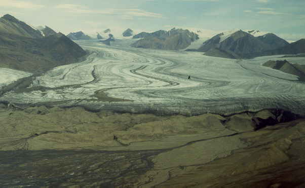
Expedition Fiord is a little oasis enclosed by glaciers and mountain ridges and our camp was well sheltered from the wind [10 km wide Thompson Glacier at 6 km distance]. We shot off the unused parachute flares and small flares [1] and burned a torn up tent using gasoline and flares [1][2] after using it as a toilet tent which is a real comfort from outside crouching in the cool wind. I made the mistake of firing off a parachute flare secretly in the tent door to surprise Jeffy but the tent was quickly filled with a suffocating sulfur smoke. The camp was very pleasant but I did get irritated for no reason from the noise of the fast flowing streams during the warm weather unable to sleep well.
The pick up at the end of the season was on time as we had window of good weather. The plane had an older pilot, the same person who refused to land at Whitsunday Bay in 1983 but now he did not even make an extra loop. He arrived at midnight, flew over the Expedition glacier [1] and just landed telling us this was like an airport [1][2]. He was already working for 24 hours with little sleep, a bit in a hurry due to the back-log as the previous week the weather was too poor to fly. During the 2.5 hour flight to Resolute he spotted Beluga whales and said "Lets go whale watching" and made a sharp turn and descended to just above sea level.
During 1985-1987 I spent the summers in Newfoundland for a project of the Canadian Geological Survey and this year I returned to study the salt domes as part of a project on the feasibility of nuclear waste storage in salt domes.
The field party consisted of only two persons and the summer student was a body builder dreaming of a 6 digit salary before he would be 30 years old and to be a (US dollar) millionaire at 40. He was okay but did not have the proper physique and endurance for expeditions. The targets this year were the thrust zones and salt domes on Northern Ellesmere Island and the biggest salt domes on Axel Heiberg Island.
The trip to Resolute started with a major delay. The blower on the Jet engines of the 737 to keep out the gravel of the unpaved Resolute Bay runway did not work. Although we left from Montreal, we ended up in Edmonton, 3500 km to the west in stead of north, as there was no accommodation in the Arctic Region, neither in Frobisher Bay nor in Yellowknife. The next day we went to Resolute Bay. I collected all the boarding passes and submitted them to the Canadian Airlines frequent Flier program and as this was a period of triple bonus points I got a free ticket the next year saving the university CAN$ 1500.
After landing in Resolute Bay with the one-day delay, we were asked if we could be ready to go in 2 hours as the weather was good for flying. "Aaahh, yes, no problem", I responded. Happy not to loose any more time and convinced I could sort out the food and gear quickly using six years of camp gear experience and with the help of one of the base aids, a very pleasant Newfoundlander I knew from the previous years. He worked here from January to October for at least 6 years leaving his family down south and was hoping for a promotion as coordinator in the radio room. We soon took off by Twin Otter plane and three hours later were dropped off in a cold, windy and rocky, uneven streambed on Northern Ellesmere Island North of Hare Fiord, hitting several rocks when landing. This was a big contrast from Toronto 12 hours earlier which had a heat wave with a temperature of 36-37 degrees Celsius. This area at 81 degrees latitude is much colder than Axel Heiberg Island as it was closer to the Arctic Ocean and surrounded by glaciers. Now it took me two weeks to get used to the cold and fighting the routine first week cold was not easy this year.
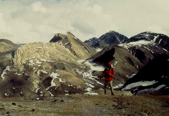
The scenery in this mountainous and glacier covered area is spectacular [1][2] but you do not sense the cold feeling from the pictures except by looking at the body posture and facial expression of the persons on pictures.
During the move to the second camp it started snowing and this did not stop for two days. The only thing to do was hide in a sleeping bag and listen to music as even reading was too cold for the hands. I was amazed how clear and crisp the music was on the Walkman hearing so many little instrument sounds I never heard before. Senses are extremely sharp during such expeditions, presumably caused by the urge for survival. Outside is was dead quiet due to the snow slowly falling down damping any noise, reminding me of the days with the dead silent, steady snow coming down in Ottawa in the winter. Ottawa and Montreal get about 8 meters of snow per winter, in portions of 10-40 cm every few days. In Ottawa, at 10 cm snow you can go out and drive a car, at 20 cm you do it with care but avoid it, and at 30-40 cm nothing moves for at least a day till the snow is cleared off the road and side walks by snowploughs.
After the snowstorm we had 5 days of summer at 8 degrees Celsius. Returning to the camp one day I did not pay attention crossing a shallow but icy stream. I slipped and fell on my back. Trying to get up in the fast running stream was not easy as the wet rucksack pulled me down. I got only half wet and luckily I was within sight of the camp. I quickly removed my wet clothes still shivering and it took me a while to get warm. I knew that you shouldn’t fall in a glacial stream, risking hypothermia. In remote parts of Quebec, the geological survey used canoes for field work for transportation in the sixties but each year someone would die by a canoe tipping over in the cold rivers, not by drowning but by hypothermia trying to get warm on the shore. Using helicopters later on was much safer and very few people died, mostly by helicopter crashes or hitting rotor blades.
The third camp was the coldest sitting at the tip of several glaciers higher up but it was the best area for studying. Crossing the numerous glacial streams was sometimes treacherous [1][2] in trying to keep dry feet when not using the waist-high waders, which were a pain to put on. Having lunch in this cold area was not simple, the food would move the blood from your fingers and toes to your stomach and we used the little Primus burner to make a cup of hot tea to keep warm. The summer student was getting tired and beaten up now. He had some 30 injuries, from back to knee problems, from cracked skin on the hand to a rough face, from sleeping problems to diarrhea. The next few days I left him home and went by myself on short trips near the camp.
A helicopter took us back to Eureka mid July flying over the large sea straits with breaking up sea ice [1]. In Eureka we spent a few days in the Geological Survey barracks, two containers refitted with windows, bunk beds and a kitchen. Sitting on flat, level ground that would not sink when sitting on a chair was a felt like a fantastic new experience. A level bed with a mattress is also fantastic and the warm shower in the weather station, well …. The container also had a book collection left by scientists but the only book I liked was Malcolm Lowry’s "Under The Volcano" I read over the next two weeks. This is an impressive masterpiece about Mexico in the late thirties and the inability to enjoy life of an English consul and his American wife. The book was said to be impossible to turn into a movie and indeed the only movie made covers only some 20% of the book missing the violent Mexican culture and empty lives of the main characters, although I do enjoy watching it.
The few days in Eureka were badly needed to recover from the past four weeks and as semi-government personnel we were invited to have free dinners at the weather station by the French-canadian cook from Montreal. The station had a logbook for all visitors and I noticed that a few tourists would stay here en route to the recently opened Lake Hazen National Park, halfway between Eureka and Alert. Lake Hazen and Eureka are the warmest parts of the Canadian High Arctic, with regular temperatures of 6-8 degrees Celsius and an average of 4 degrees Celsius in the summer. The tourists were generally retired people from the US and the only tourists prepared to pay the US$ 8000 for just two weeks, not including the US$ 1500 flight to Resolute Bay. They were charged US$ 50-70 per meal at the weather station and the simple accommodation in bunk beds was over US$ 100 per person. Hilton Hotel prices at YMCA comfort.
We did a few trips around Eureka. One was along the only dirt road that runs from the airport, to the station and a further west to a cape with satellite dishes. These were built at this location as the high latitude required an open space for receiving signals and they were aimed to the south to a satellite at only 1 or 2 degrees above the open sea. The dishes were used for the station telecommunications and also allowed us to make phone calls south which were only allowed between 7 and 8 PM. I nearly went of the road driving the old PCSP government truck, which would have been a disaster as it was the only truck for our group of scientists. Renting a truck from the weather station was very costly. This truck was flown in a few years ago as a favor of the Canadian army using a Hercules transport plane. My student took the truck once for a night ride, and he got stuck in the mud by driving off the road. Great student joke and very typical so I let him dig it out first and gave him a hand finally using wooden planks to get it out. It was a good learning experience. On another trip we borrowed the stations mountain bikes that were bought to encourage the stations personal to do some physical exercise but nobody used them. After a few kilometers along the beach having a fierce head wind we got stuck in beach gravel and sand and walked along with the bikes. The beach had a lot of plastic, rope, plywood, glass bottles, etc., more than you would see on a beach in Europe on a winter day. This must have drifted in along the sea strait and kept on accumulating. Another example how every corner of the world is getting polluted. On the way back we went with the wind and cycling was no problem. One night as I was walking from the station to our camp a wolf crossed the road. It looked at me and wandered off, just like a dog showing no interest. National Geographic has shown documentaries of the white Arctic wolves of Eureka that have a den nearby. The cook often feeds them with left over food.
Our next targets were the giant Gibbs [1] and Mokka Fiord salt domes [1][2][3]. The weather felt very pleasant in this warmer area after enduring the cold weather of Northern Ellesmere Island. We even took outside showers on sunny days [1]. The move to Gibbs Fiord was tricky as the dry and windy weather caused localized loess storms similar to sand storms in the Sahara [1] and the helicopter flew above it still risking dirt in the engine. This was exciting to see as this was a life natural example on the formation of loess in the Europe in front of the ice caps during glacial periods learned during Geography lessons at school
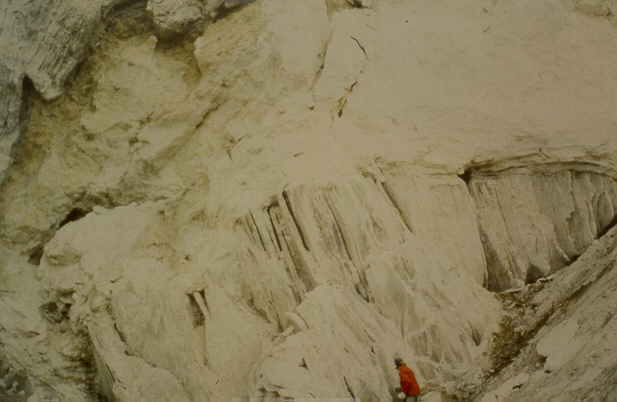
The southwest tip of the Gibbs Fiord salt dome had giant platy crystals of gypsum, up to 2 meters across and a museum collector item. I thought of asking the helicopter to lift one of the 300-500 kg crystals to Eureka and donating it to a museum but settled for a 15 kg piece 54 cm across that could be carried home by smashing up one of the not so big pieces. The Mokka Fiord salt dome [1][2][3] has an elevation of 500 meters and deep valleys [1], with occasionally large veins of swallow tail gypsum crystals up to 45 cm long, again museum pieces and I collected one piece. I should donate both pieces I have now to e.g. the Artis Geological Museum in Amsterdam.
In the Gibbs Fiord dome we passed a wolf den, a cave they dug out in the soft gypsum and the outside was littered with bones. My student thought this was very interesting and wanted to check it out but I insisted on leaving as soon as possible. Wolf packs have around 4-8 animals and there could have been cubs in the den. They would have defended them fiercely on spotting us, they tend to leave one or two on guard, and we did not carry the heavy shotgun. This reminded me of an aggressive German shepherd on a farm in Holland that just had a litter and almost attacked me if it wasn’t for the farmer stepping in. The dog knew me but did have a wild character from living in the woods for a while and was adopted by the farmer only a few months earlier.
The summer is now at his height and above 4 degrees Celsius mosquitoes come out. At first there are only one or two circling your head but they can smell you for kilometers and within two hours there is a buzzing cloud. A windy, high area works best to avoid them so we only have lunch here. On such a day, we have lunch in one of the higher valleys of the Mokka Fiord salt dome and the single mosquito approaching every few minutes like attacking jet fighters get hit by throwing soil. Great fun but when I do not pay attention getting up and walking back wards it turns out the rock face is much closer and I hit my head badly causing a mild concussion. This is serious, I carefully and more slowly move around, finish the work but I need to lay down as much as possible. I had a friend hitting his head once, neglected it, went on a field trip anyway, started throwing up, and had to be repatriated and spent 3 months in hospital.
Going home from Resolute through Montreal and Toronto to Amsterdam was problematic this year. I waited for three days, a new delay record. Every midnight we would go to the airport with our luggage, the airline jet would fly over and try to land but the fog would roll in at night and create a 100 m thick blanket on the run way, typical of the cooler night. The next year the schedule was changed to daytime departures.
The 1989 expedition on Northern Ellesmere Island was the year of snow, snow and snow. Freak weather systems kept on rolling in from the south and covered the mountains in a near permanent layer of one or two meters of snow. Only near sea level the snow would melt. This is very unusual for this area, as it is know to be an Arctic desert.
We went with a large group, our professor, Matt from England, the MSc student with his field assistant and Jeff (another student) my field assistant.
With the experience of last summer realizing Northern Ellesmere Island is much colder and using the knowledge from the Newfoundland fieldwork in 1985, 1986 and 1987, I ordered Coleman gasoline lamps as portable stoves, surprising equipment for an area that never gets dark. These proved to be very good to heat up the tents, especially in the morning. We would always light a lamp before getting up and in 5 minutes the tent would be warm.
In Resolute Bay we met an artist who installed a one-meter compass needle (for a horizontal rotation) and half meter long inclinometer needles (for a vertical rotation) outside the base near the sea [1][2][3]. As we were so close to the magnetic pole, only 100 km, they spun around slowly, both vertically and horizontally in a seemingly chaotic way.
The six of us were dropped of North of Hare Fiord on Northern Ellesmere Island on muddy tundra near the shore and luckily the plane did not get stuck [1]. The first week near the coast was fine and the only (pleasant) incident was the pack of 4 wolves [white dots in the distance]. They came back to our camp several times and we left a student home to guard the tents as they could easily rip a tent in search of food as happened in 1984 on Strand Fiord when we left a tent with garbage. The scenery here is special, frozen sea ice [1], icebergs [1] and glaciers almost touching the sea [1].
The next camp higher up was cold. The area was covered in snow and it was not easy to look at the rocks. We saw a fox looking for food in our white snow-covered valley. The move to the third camp was during a starting snowstorm. I went first to guide the helicopter to the new camp using aerial photographs. Jeff would follow on the second trip. With the weather closing down we had the choice to wait for another day or to try it. Our helicopter pilot was an ex Vietnamese pilot and he was used to scary situations so we left. Hovering just above the sea ice of Otto Fiord with numerous icebergs and just below the low snow clouds, the dim light, the sparse seals near icebergs gave this a feeling of an apocalypse. "My time has must have come", like the crazy colonel Kurd in the movie Apocalypse Now. Missing in the scene was only a lonely polar bear. We slowly moved up the mountainous river valley leading us to the camp higher up in the mountains and dropped of the gear. With the low ceiling and poor visibility, the pilot needed me for navigation to find Jeff quickly at the first camp and being able the find back the new camp. In the mean time it started snowing and we almost cancelled the second move taking us back to Eureka but after carefully following the first route we finally found the new camp. We said good bye to the pilot hoping he would make it back as the fuel was getting low else he would have to land on the sea ice and call for help from the second helicopter at Eureka.
The next morning the tents were bright, caved in, and cold. Still in our sleeping bags we realized that it must have snowed for most of the night [1]. This camp was a disappointment as nearly all the rocks were covered in snow and apart from some creative fun like e.g. make a sledge of a garbage bag [1][2][3] or fun with a small avalanche [1][2][3] we did not accomplish much. Jeff crashed into a rock after slaying down the snow slope as he could not stop in time and hurt himself on the shoulder and knee. The fourth camp was jointly with Matt and his student and was similar except that it first snowed for 3 days [1][2] and when we finally could walk around we had to walk through a meter of snow.
At the fifth camp I would join a French Professor with his son. This is the camp south of Hare Fiord in the cold mountainous area surrounded by glaciers I visited last year. Again the weather came down and it snowed making trips higher up difficult by the deep snow. [1]. One day the temperature was suddenly 18 degrees Celsius, presumably by freak warm weather moving in from the South. This started a massive run off of water in the snow-covered area but as we were near the glaciers we were fine. Further North, Matt, Jeff and the third students crossed a river in the morning at waist level but at night the fast flowing river came to their shoulders. Luckily they fixed a rope but the third student was wearing a heavy packsack and the shotgun. The rope somehow got loose and the fast current took him along but luckily he drifted to the camp side while clinging on to the rope. This saved his life. The same night I had them on the radio but though they were playing a joke, as there was little response and this would not change for the next few days. When I saw them later they told me they were unable to work for a week. This was the closest call in loosing a life on one of my expeditions. The golden rule was not to cross a stream above knee level in the morning as it would be higher at night but inexperience combined with freak weather caused this incident. Another rule was to never wear a packsack when crossing a deep stream but to throw it over the stream and certainly leave the gun home.
The camp move back to Eureka was again difficult. First the French professor and his son were moved to another camp and keeping only minimal gear like a radio, a shotgun, sleeping bag and tent, I was waiting for the helicopter. The clouds suddenly came down and it started snowing. The helicopter pilot was not happy after he finally found me between the snowy clouds in the mountainous river valley [1] and I should have radioed him not to try it and spent the night alone in the field. Jeff came back to Eureka with me and here he told the story of the river crossing during the freak weather. After this incident they did not do anything for several days and were just recovering.
In Eureka I again met the French Canadian cook from Montreal I knew from the past years of visits to the weather station. As always he offered us free diners but now we had to listen to his sad story. While drinking whisky, he told us that he could not understand why his wife of 18 years suddenly divorced him. He worked year round at the station for the past 10 or 15 years, had a good salary, would spent the yearly 4 weeks of holidays with his wife in the Montreal and would call her once a week. Some sort of boat captain’s marriage. Fine, n’est pas? He was in a sorry state, missing the exuberance and sharp remarks with his heavy French Canadian accent as I knew him from previous years.
Our last camp was planned for South Fiord on far west side of Axel Heiberg Island and right on the Arctic Ocean, some 1.5 hour flying and the absolute limit of the range of the helicopter. We crossed the 2000 meter high mountain range of Axel Heiberg Island and arriving at South Fiord I took a quick decision. The area was covered completely in snow and no plane could land here to pull us out as was planned. Also, the snow cover made it impossibly to study all the rocks. ‘Forget it, too risky", I told the pilot, and we went to our fall back option half way, the 1984 camp at Expedition Fiord and a little oasis. Here Jeff had interesting radio conversations as we discovered that the mostly female biologists were having chat session at 8 PM using the second unused channel. This was great, female voices on the radio for the first time in 6 weeks and they were so beautiful! Jeff often played the "Arctic Phantom", just calling in with freak low-pitched messages and nobody found out who this was. It could have been anybody up to a distance of 1000 km, the range of the radio. We met some of them later at Eureka, and were so disappointed by their looks. They had nice voices but they were typical enduring biologists…, big.
The last camp move back from Expedition Fiord to Eureka was the most difficult one ever. For three days the weather was poor and the helicopter could not cross the main mountain range between Eureka and our camp. We were known on the radio as the camp that could not move, a true "Expedition Fiord" as was our calling name on the radio, and I was very happy I made the decision not to camp even farther at South Fiord. On the fourth day, the helicopter finally arrived. We were finishing off our last loaf of bread now with sugar as nearly all the food was finished. The last resort would have been to shoot some ducks or the baby caribou in the valley upsetting its mother. When the helicopter landed I already split up the gear in first and second load, most important stuff going first. The plan was very different this time, our Vietnamese pilot said he could only do one load and the rest would be left in the nearby McGill University cabin. I put a note with the tents and other gear in the cabin with the owner’s name, the Geological Survey of Canada, and hopefully some year it would be returned. The three of us crossed the mountain range flying at low altitude through the canyons above the valley glaciers, as the ceiling was low. We finally made it back safely but this was nerve wrecking as the fuel was getting low and we had a heavy load with two passengers and still too much gear.
In Eureka Matt and his student finally joined us. Matt did not wash his socks for the entire seven weeks. In the warm shower area I asked him to put them in air tight plastic before throwing in the bin as the smelled badly. Matt and his student were definitely beaten up, physically and mentally from spending most of the 7 weeks in the snow.
Back in Resolute Bay there were 3 single engine sports planes of Americans. They planned to fly to the North pole not realising that in this area all the fuel caches are flown in. They would need fuel in Eureka, Alert and some where on the ice. Costs of fuel is high, some 10-30 US$ per liter if not more and if you can arrange it. They changed their mind and decided to the magnetic North Pole at only a 100 km distance so they would still have story to tell. In the nineties Dutch people tried to cycle to the magnetic North Pole over the ice. Sounds like an original idea but the ice floats are a mix of very rough old and new ice and even the tundra is not ideal for cycling as I found out in Eureka. They finally did the 100 km by walking and did not cycle much if anything.
Epiloque
"Remembrance of Arctic Treks past" would be a good title and after spending a total of 10 months in the Arctic I feel attached to the area. Naturally I tend to remember the pleasant parts of a trip. I had no problem handling the work, rarely having an injury, although loosing 5 kg every year during two months of uncomfortable camping is not pleasant. We were all very tired after 2 months, especially the older people like our professor [1].
What you do not see on the pictures are the chapped hands and lips, the dry eyes, poor sleep and other physical discomfort like trying to go to the bathroom but the grim faces do expose it. Never pea with the fierce wind, the vacuum created will call turbulence and spray you. Taking a shit is most comfortably done wearing the winter parka (less cold) but requires some coordination to keep it clean. The small tents are always dusty and the wind is generally fierce. You generally get pretty cold after walking two hours outside in 1-4 degrees Celsius especially after lunch. Finally, there is the sense of absolute loneliness with only 1 or 2 other persons around.
The level of pollution is scary. Even here the air and beaches are visibly polluted. Dioxin and other chemicals are concentrating in the fat of seals and fish, spreading to other animals. Canada is trying very hard to keep this area pristine wilderness but with so many scientist and some rich tourists already pouring in using motorized transport, like in Antarctica, you wonder. The animals still react very natural and have no idea who we are, but for how long?
A radical statement would be to do a step change in using wilderness. Do the reverse, create cities for people with closed gates and leave nature in the remaining space but this is setting the clock back to BC times and we simply have too many human beings. E.g. the Persians controlling the Middle East from Pakistan to Greece to Egypt in the 5th centry BC only had 10 million people.
Nevertheless, even in France it could be done as so many people moved to the city and large part of the Midi are near empty. Now we create National Parks for wild animals and still don’t keep the people out. An improvement would be to vastly increase true wilderness area and not only leave it untouched but prevent secondary pollution.
Geologically speaking we are in the middle of a mass-extinction period happening every 50-100 million years and lasting for perhaps five to ten thousand years. This one started 10000 years ago with the extinction of large mammals, probably killed caused by human beings.
Summary of pictures from the Canadian High Arctic
Photos from geological expeditions on Axel Heiberg Island and Ellesmere Island up to 200 km from the weather station Eureka in the summers of 1982, 1983, 1984, 1988 and 1989. Organized by the University of Toronto in collaboration with the Geological Survey of Canada and Polar Continental Shelf Project (Energy, Mines and Resources, Canada).
|
TITLE (to click on) |
File name |
Date |
|
Map of Northern Canada, logistic support, Resolute Bay and Eureka |
|
|
|
arcmap1.jpg |
July 1982 |
|
|
arcmap2.jpg |
July 1982 |
|
|
Resolute Bay, the Inuit village. With a view over the Lancaster Sound. |
arctic04.jpg |
July 1982 |
|
Frobisher Bay or Iqualuit town sign at the Airport, Baffin Island. Also in Inuit language. |
arctic04.jpg |
July 1982 |
|
arctic07.jpg |
July 1982 |
|
|
arctic08.jpg |
July 1982 |
|
|
arctic09.jpg |
August 1983 |
|
|
Geological Survey of Canada camp on Strand Fiord, western Axel Heiberg Island, summer 1983. |
arctic28.jpg |
July 1983 |
|
arctic29.jpg |
July 1983 |
|
|
Logistics: Twin Otter planes and Bell 206 helicopters |
|
|
|
arctic21.jpg |
July 1989 |
|
|
Helicopter, Bell 206, dropping camping gear, between Expedition and Strand Fiord. |
arctic23.jpg |
July 1984 |
|
arctic24.jpg |
July 1988 |
|
|
Twin Otter landing on the tundra at Expedition Fiord, in front of the main Expedition Glacier, about 10 km wide and 80 km long. Distance to glacier is 6 km. Detail of plane |
arctic25.jpg; arcti25l.jpg |
July 1984 |
|
Near Mokka Fiord, Twin Otter landed on the tundra, dropping camping gear. |
arctic26.jpg |
June 1982 |
|
Near Expedition Fiord camp, with Twin Otter flying above Expedition glacier. |
arctic32.jpg |
July 1984 |
|
arctic27.jpg |
July 1984 |
|
|
Animals and plant life: Muskox, cariboe, hares, wolves, ... |
|
|
|
arctic54.jpg |
July 1982 |
|
|
arctic55.jpg |
July 1982 |
|
|
arctic56.jpg |
June 1983 |
|
|
arctic57.jpg |
July 1983 |
|
|
arctic58.jpg |
July 1982 |
|
|
arctic59.jpg |
July 1982 |
|
|
arctic60.jpg |
July 1983 |
|
|
arctic61.jpg |
July 1982 |
|
|
arctic62.jpg |
July 1982 |
|
|
arctic63.jpg |
July 1983 |
|
|
Arctic200.jpg |
July 1983 |
|
|
arctic64.jpg |
July 1984 |
|
|
arctic65.jpg |
July 1982 |
|
|
arctic201.jpg |
July 1982 |
|
|
arctic66.jpg |
July 1983 |
|
|
Arctic67.jpg |
July 1983 |
|
|
Arctic68.jpg |
July 1983 |
|
|
Arctic203.jpg |
July 1983 |
|
|
Arctic69.jpg |
July 1989 |
|
|
arctic70.jpg |
July 1989 |
|
|
Mature lemming hold with glove as they shit trying to escape. |
arctic71.jpg |
July 1984 |
|
arctic72.jpg |
July 1989 |
|
|
Huskies in Frobisher Bay (now called Iqualuit), Baffin Island. |
arctic73.jpg |
June 1982 |
|
Scenery, panorama, mountains, geologist playing, ..... |
|
|
|
arcticra.jpg |
Jul 1982 |
|
|
arctic19.jpg |
July 1988 |
|
|
arctic20.jpg |
July 1982 |
|
|
Deep valley in Mokka Fiord salt dome, Eastern Axel Heiberg Island. Student at work (left). |
arctic87.jpg |
July 1988 |
|
aglacier.jpg |
Jul 1989 |
|
|
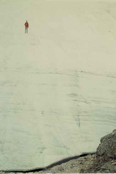
Canadian High Arctic: Glacier near Hare Fiord, Ellesmere Island, Arctic Canada. |
avalley.jpg |
Jul 1989 |
|
arctic13.jpg |
July 1982 |
|
|
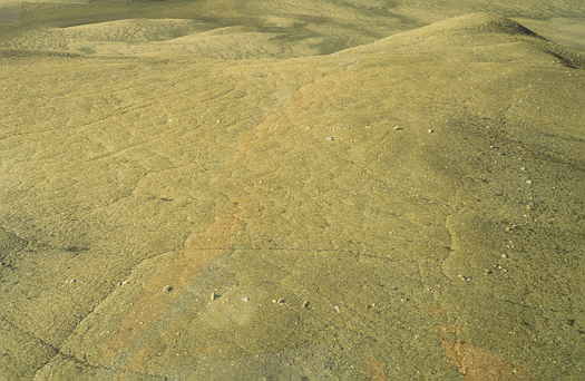
Polygons in the tundra, some are not hexagonal but square due to sloping hill near stream. |
arctic14.jpg |
July 1982 |
|
arctic17.jpg |
August 1988 |
|
|
Gibs Fiord salt dome, view from a helicopter. Deepest valleys some 50 m high. |
arctic33.jpg |
July 1988 |
|
arctic34.jpg |
July 1983 |
|
|
arctic35.jpg |
July 1983 |
|
|
arctic46.jpg |
July 1989 |
|
|
arctic47.jpg |
July 1989 |
|
|
Arctic48.jpg |
July 1989 |
|
|
Arctic49.jpg |
July 1982 |
|
|
arctic50.jpg |
July 1989 |
|
|
arctic79.jpg |
June 1988 |
|
|
arctic80.jpg |
June 1988 |
|
|
Western Axel Heiberg Island with salt ridge (light grey) and view towards main ice cap. |
arctic88.jpg |
July 1983 |
|
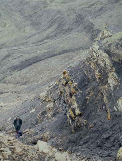
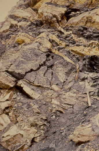
Salt dome, with exposed salt (near vertical layers), covered by anhydrite (white, powdery) |
arctic74.jpg |
June 1983 |
|
arctic75.jpg |
July 1984 |
|
|
Thin anhydrite intrusions along fault zone in shales, detail. |
arctic76.jpg |
July 1984 |
|
Camps life, during good and bad weather ... |
|
|
|
arctic30.jpg |
July 1984 |
|
|
Same, shooting off parachute flares at the end of the season. |
arctic31.jpg |
July 1984 |
|
arctic202.jpg |
July 1983 |
|
|
Torn up tent being burned with naphtha and flares, sequence 1 and 2 of 4 pictures. |
arctic38.jpg |
July 1984 |
|
arctic39.jpg |
July 1984 |
|
|
arctic40.jpg |
June 1983 |
|
|
arctic41.jpg |
June 1983 |
|
|
arctic42.jpg |
July 1989 |
|
|
arctic43.jpg |
July 1989 |
|
|
arctic44.jpg |
July 1989 |
|
|
arctic45.jpg |
July 1989 |
|
|
arctic51.jpg |
July 1989 |
|
|
arctic52.jpg |
July 1989 |
|
|
arctic53.jpg |
July 1982 |
|
|
Camp between diabase sills (black) on Western Axel Heiberg Island, near Strand Fiord. |
arctic85.jpg |
July 1983 |
|
arctic86.jpg |
July 1984 |
|
|
arctic81.jpg |
July 1988 |
|
|
Geologists at work |
|
|
|
Geology Professors at work, Jean-Luc Bouchez (Nantes) and Fried Schwerdtner (Toronto). |
arctic01.jpg |
July 1982 |
|
arctic22.jpg |
June 1989 |
|
|
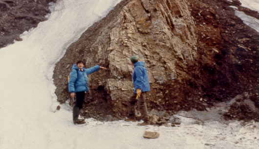
Tired geologist after spending a few weeks on Northern Ellesmere Island |
arctic02.jpg |
July 1984 |
|
arctic83.jpg |
July 1988 |
|
|
arctic82.jpg |
July 1988 |
|
|
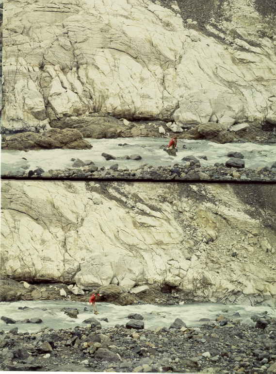
Crossing a glacial stream, South of Hare Fiord. Top: looking. Bottom: jump. |
arctic84.jpg |
July 1988 |
|
Archeology: Inuit Culture, around 1400 AD |
|
|
|
Inuit hut of the Thule Culture around 1400 AD, made of rock slabs and whale bones. |
arctic06.jpg |
July 1982 |
|
arctic06.jpg |
July 1982 |
|
|
arctic18.jpg |
July 1988 |
|
|
arctic15.jpg |
July 1982 |
|
|
Art |
|
|
|
arctic10.jpg |
June 1989 |
|
|
arctic11.jpg |
June 1989 |
|
|
arctic12.jpg |
June 1989 |
|
|
Guns, guns, guns, .... |
|
|
|
Snow storm on top of a mountain (in the clouds), Fried and Jean (heavily armed). |
arctic77.jpg |
July 1982 |
|
arctic78.jpg |
June 1983 |
|
|
arctic36.jpg |
July 1984 |
![[1]](arcmap1.jpg)
![[1]](arctic30.jpg)
![[1]](arctic07.jpg)
![[2]](arctic08.jpg)
![[1]](arcmap2.jpg)
![[1]](arctic03.jpg)
![[2]](arctic73.jpg)
![[1]](arctic04.jpg)
![[1]](arctic21.jpg)
![[2]](arctic25.jpg)
![[3]](arctic26.jpg)
![[4]](arctic32.jpg)
![[1]](arctic23.jpg)
![[1]](arctic14.jpg)
![[1]](arctic57.jpg)
![[2]](arctic55.jpg)
![[1]](arctic65.jpg)
![[2]](arctic201.jpg)
![[1]](arctic58.jpg)
![[1]](arctic71.jpg)
![[2]](arctic69.jpg)
![[1]](arctic59.jpg)
![[1]](arctic63.jpg)
![[2]](arctic200.jpg)
![[1]](arctic60.jpg)
![[1]](arctic70.jpg)
![[1]](arctic67.jpg)
![[1]](arctic68.jpg)
![[1]](arctic64.jpg)
![[1]](arctic54.jpg)
![[1]](arctic05.jpg)
![[2]](arctic06.jpg)
![[1]](arctic20.jpg)
![[1]](arctic19.jpg)
![[1]](arctic13.jpg)
![[1]](arctic78.jpg)
![[1]](arctic77.jpg)
![[1]](arctic49.jpg)
![[1]](arctic61.jpg)
![[2]](arctic62.jpg)
![[1]](arctic203.jpg)
![[1]](arctic34.jpg)
![[2]](arctic35.jpg)
![[1]](arctic28.jpg)
![[1]](arctic29.jpg)
![[1]](arctic88.jpg)
![[1]](arctic53.jpg)
![[2]](arctic85.jpg)
![[1]](arctic66.jpg)
![[1]](arctic202.jpg)
![[1]](arctic09.jpg)
![[1]](arctic40.jpg)
![[2]](arctic41.jpg)
![[1]](arctic86.jpg)
![[1]](arctic31.jpg)
![[1]](arctic38.jpg)
![[2]](arctic39.jpg)
![[2]](arcti251.jpg)
![[1]](arctic79.jpg)
![[2]](arcti80.jpg)
![[1]](arctic82.jpg)
![[2]](arcti88.jpg)
![[1]](arctic33.jpg)
![[1]](arctic81.jpg)
![[1]](arctic17.jpg)
![[1]](arctic87.jpg)
![[1]](arctic10.jpg)
![[2]](arctic11.jpg)
![[3]](arctic12.jpg)
![[white dots in the distance]](arctic72.jpg)
![[1]](arctic22.jpg)
![[1]](arctic50.jpg)
![[1]](arctic42.jpg)
![[1]](arctic43.jpg)
![[2]](arctic44.jpg)
![[3]](arctic45.jpg)
![[1]](arctic46.jpg)
![[2]](arctic47.jpg)
![[3]](arctic48.jpg)
![[1]](arctic51.jpg)
![[2]](arctic52.jpg)
![[1]](aglacier.jpg)
![[1]](avalley.jpg)
![[1]](arctic02.jpg)